MyTopo
Little Aguja Mountain Texas US Topo Map
Couldn't load pickup availability
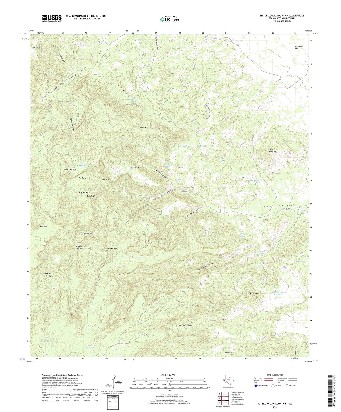
2019 topographic map quadrangle Little Aguja Mountain in the state of Texas. Scale: 1:24000. Based on the newly updated USGS 7.5' US Topo map series, this map is in the following counties: Jeff Davis. The map contains contour data, water features, and other items you are used to seeing on USGS maps, but also has updated roads and other features. This is the next generation of topographic maps. Printed on high-quality waterproof paper with UV fade-resistant inks.
Quads adjacent to this one:
West: Friend Mountain
Northwest: Buckhorn Mountain
North: Antelope Flat
Northeast: Toyahvale
East: Big Aguja Mountain
Southeast: Swayback Mountain
South: Casket Mountain
Southwest: Mount Locke
Contains the following named places: Airplane Tank Spring, Balance Rock, Bear Canyon, Bear Cave Mountain, Bear Mountain, Big Bear Tank, Blue Hole, Blue Waterhouse Canyon, Bob Manning Canyon, Buffalo Trail Scout Camp, Carmac Tank, Dark Canyon, Dark Canyon Spring, Deer Tank, Eye of the Needle, Ezras Bedground, Fishing Springs, Forbidden Mountain, Goat Mountain Windmill, House Pasture Spring, Jack Tank, Jimenez Tank, Laguna Tank, Little Aguja Mountain, Madera Springs Lodge, Million Dollar Canyon, Needle Rock, Orchard Spring, Pig Pen Canyon, Rustlers Flat, The Notch, The Park, The Pole Pens, Timber Mountain, Trickey Gap, Trickey Gap Park, Walker Tank, White Mountain, White Mountain Tanks, White Tank, Wood Canyon