MyTopo
Mount Locke Texas US Topo Map
Couldn't load pickup availability
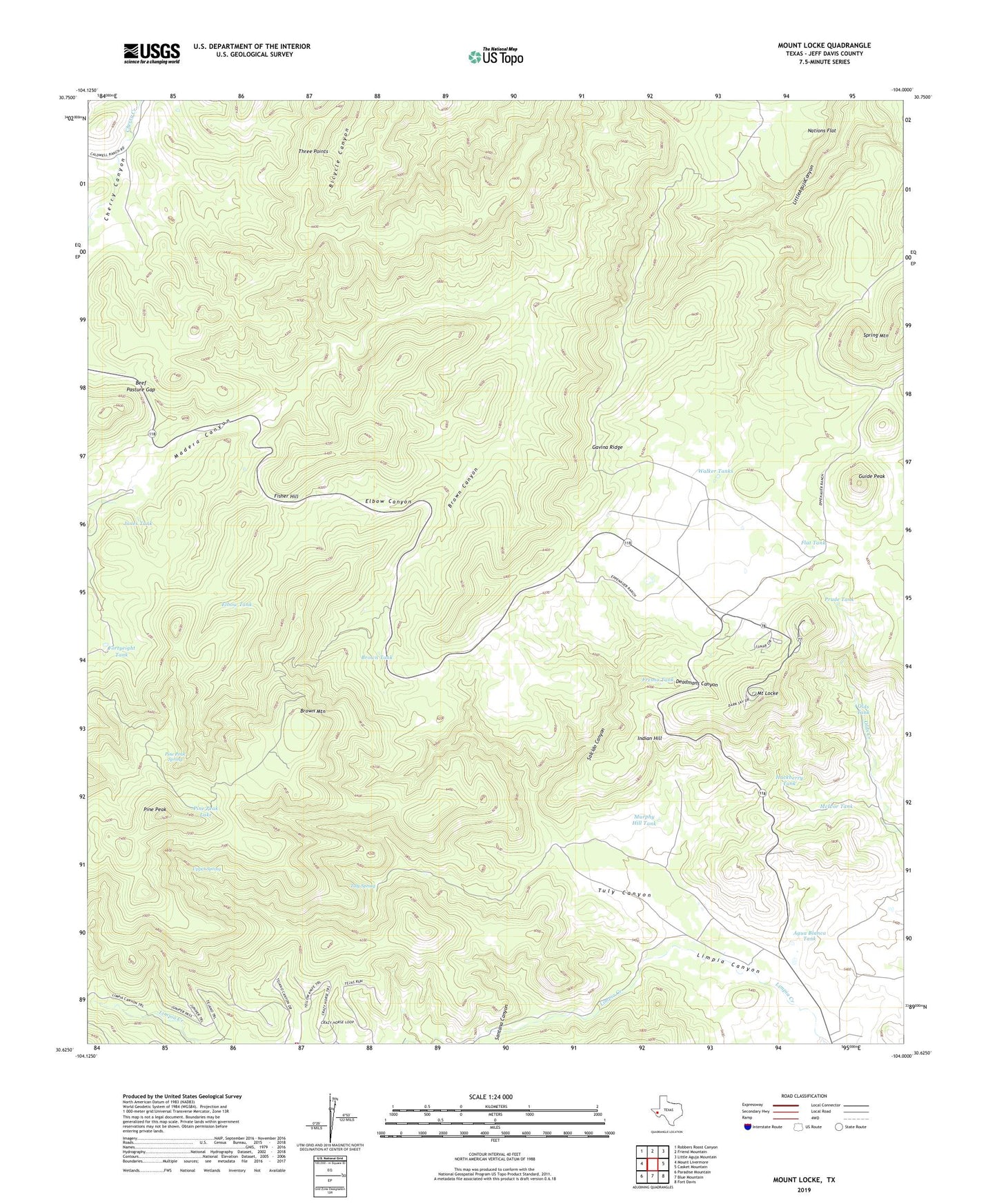
2022 topographic map quadrangle Mount Locke in the state of Texas. Scale: 1:24000. Based on the newly updated USGS 7.5' US Topo map series, this map is in the following counties: Jeff Davis. The map contains contour data, water features, and other items you are used to seeing on USGS maps, but also has updated roads and other features. This is the next generation of topographic maps. Printed on high-quality waterproof paper with UV fade-resistant inks.
Quads adjacent to this one:
West: Mount Livermore
Northwest: Robbers Roost Canyon
North: Friend Mountain
Northeast: Little Aguja Mountain
East: Casket Mountain
Southeast: Fort Davis
South: Blue Mountain
Southwest: Paradise Mountain
This map covers the same area as the classic USGS quad with code o30104f1.
Contains the following named places: Agua Blanca Tank, Beef Pasture Gap, Brown Canyon, Brown Mountain, Brown Tank, Davis Mountain Resort Volunteer Fire Department, Deadmans Canyon, Elbow Canyon, Elbow Tank, Fisher Hill, Flat Tank, Fortyeight Tank, Fresno Tank, Gavina Ridge, Guide Peak, Hackberry Tank, Indian Hill, Jones Tank, Limpia Windmill, Madera Canyon Roadside Park, McDonald Observatory, McIvor Tank, Mount Locke, Murphy Hill Tank, Nations Flat, Oil Well Windmill, Olds Tank, Pete Trap Windmill, Pine Peak, Pine Peak Lake, Pine Peak Spring, Prude Tank, Right Hand Creek, Salcido Canyon, Salcido Windmill, Santana Canyon, Spring Mountain, Three Points, Tuly Canyon, Tuly Spring, Upper Spring, Walker Tanks