MyTopo
Swayback Mountain Texas US Topo Map
Couldn't load pickup availability
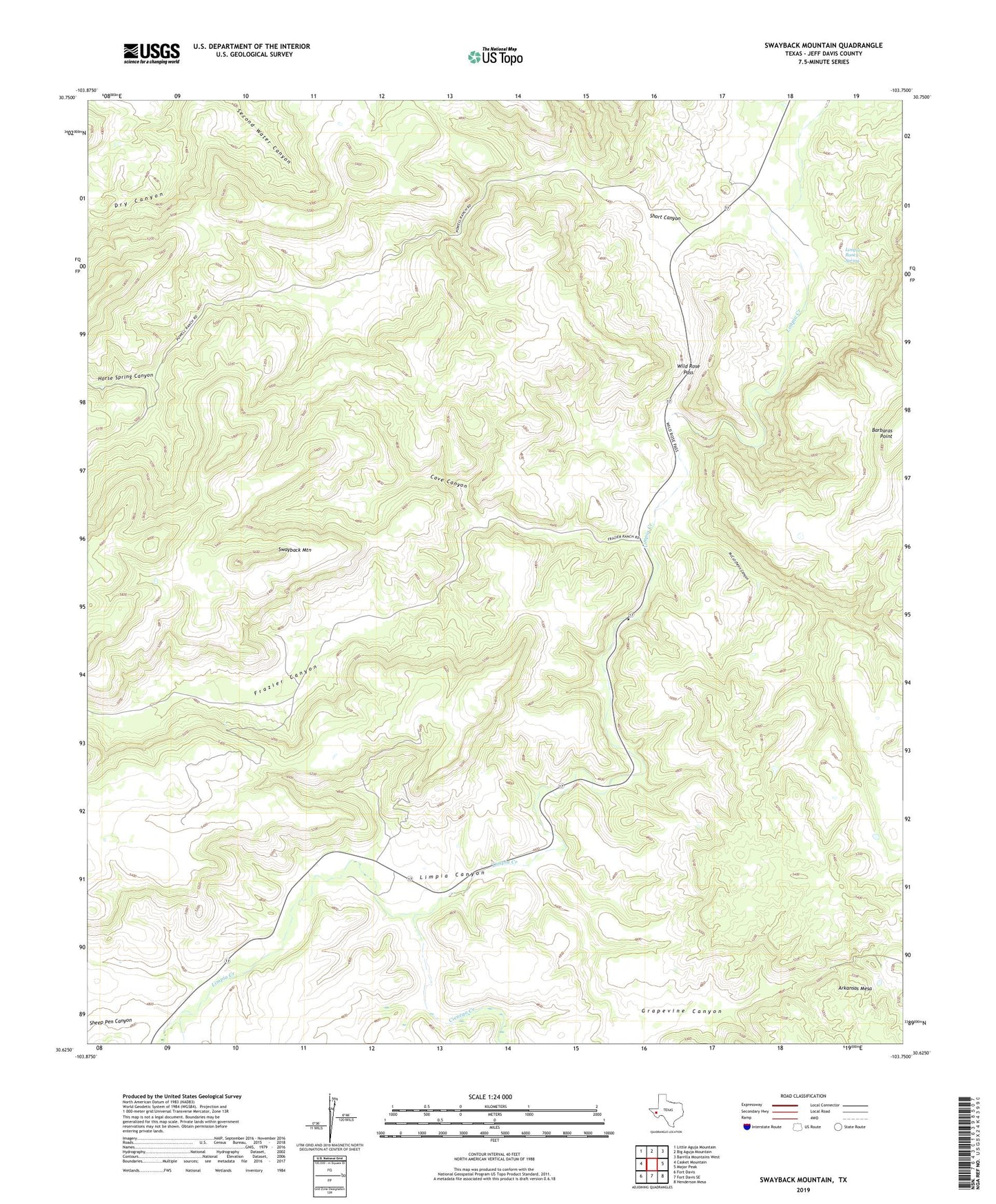
2022 topographic map quadrangle Swayback Mountain in the state of Texas. Scale: 1:24000. Based on the newly updated USGS 7.5' US Topo map series, this map is in the following counties: Jeff Davis. The map contains contour data, water features, and other items you are used to seeing on USGS maps, but also has updated roads and other features. This is the next generation of topographic maps. Printed on high-quality waterproof paper with UV fade-resistant inks.
Quads adjacent to this one:
West: Casket Mountain
Northwest: Little Aguja Mountain
North: Big Aguja Mountain
Northeast: Barrilla Mountains West
East: Major Peak
Southeast: Henderson Mesa
South: Fort Davis SE
Southwest: Fort Davis
This map covers the same area as the classic USGS quad with code o30103f7.
Contains the following named places: Cave Canyon, Chihuahua Creek, Cienega Creek, Frazier Canyon, Grapevine Canyon, Horse Spring Canyon, Limpia Ranch Spring, McCutcheon Canyon, Powell Ranch, Sheep Pen Canyon, Short Canyon, Swayback Mountain, Wild Rose Pass