MyTopo
Friend Mountain Texas US Topo Map
Couldn't load pickup availability
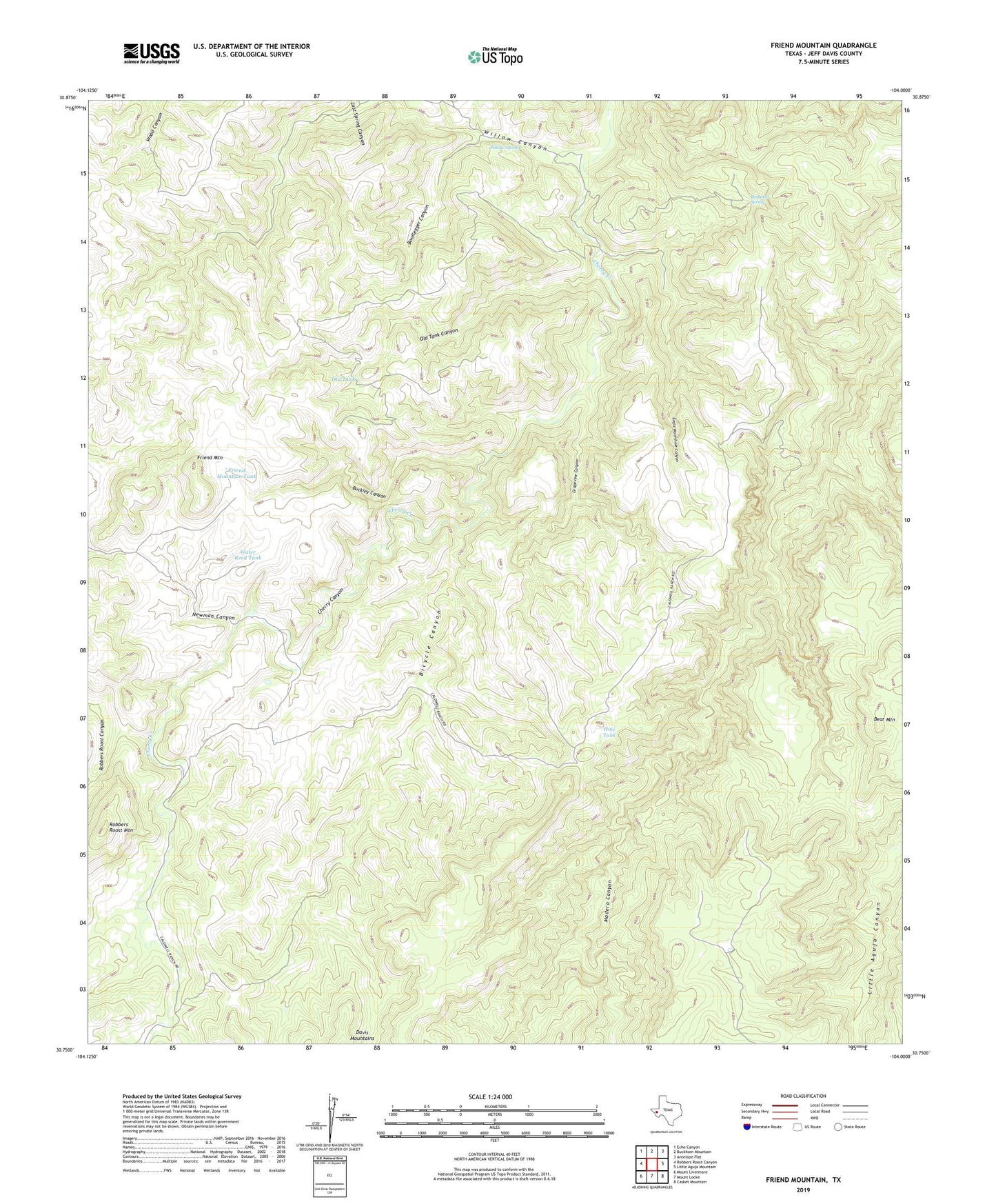
2022 topographic map quadrangle Friend Mountain in the state of Texas. Scale: 1:24000. Based on the newly updated USGS 7.5' US Topo map series, this map is in the following counties: Jeff Davis. The map contains contour data, water features, and other items you are used to seeing on USGS maps, but also has updated roads and other features. This is the next generation of topographic maps. Printed on high-quality waterproof paper with UV fade-resistant inks.
Quads adjacent to this one:
West: Robbers Roost Canyon
Northwest: Echo Canyon
North: Buckhorn Mountain
Northeast: Antelope Flat
East: Little Aguja Mountain
Southeast: Casket Mountain
South: Mount Locke
Southwest: Mount Livermore
This map covers the same area as the classic USGS quad with code o30104g1.
Contains the following named places: Bicycle Canyon, Bonanza Spring, Bootlegger Canyon, Buckley Canyon, Caldwell Ranch, Davis Mountains, Deadman Tank, Eagle Waterhole Canyon, Friend Mountain, Friend Mountain Tank, Grapevine Canyon, Hole Tank, Lost Spring Canyon, Newman Canyon, Old Tank, Old Tank Canyon, Owl Tank, Robbers Roost Mountain, The Lodge, Water Reed Tank, Willow Canyon, Willow Spring, Willow Tank