MyTopo
Louise Texas US Topo Map
Couldn't load pickup availability
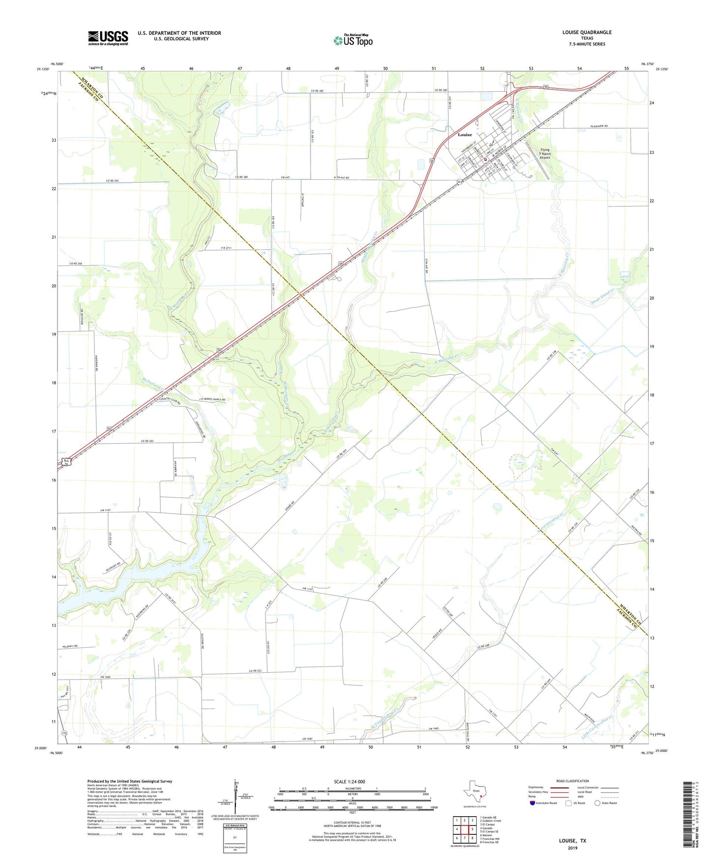
2019 topographic map quadrangle Louise in the state of Texas. Scale: 1:24000. Based on the newly updated USGS 7.5' US Topo map series, this map is in the following counties: Jackson, Wharton. The map contains contour data, water features, and other items you are used to seeing on USGS maps, but also has updated roads and other features. This is the next generation of topographic maps. Printed on high-quality waterproof paper with UV fade-resistant inks.
Quads adjacent to this one:
West: Ganado
Northwest: Ganado NE
North: Gobbler Creek
Northeast: El Campo
East: El Campo SE
Southeast: Francitas NE
South: Francitas NW
Southwest: Manson
Contains the following named places: East Mustang Creek, East Side School, Flying V Ranch Airport, Ganado Division, KIOX-FM (El Campo), Long Branch, Louise, Louise Census Designated Place, Louise Elementary School, Louise High School, Louise Oil Field, Louise Post Office, Louise Volunteer Fire Department, McFarland Creek, Middle Mustang Creek, Mott Branch, Mustang Country Club, Stage Stand Creek, West Mustang Creek, Wharton County Constable's Office Precinct 3, White Hall, ZIP Code: 77962