MyTopo
Lyons Texas US Topo Map
Couldn't load pickup availability
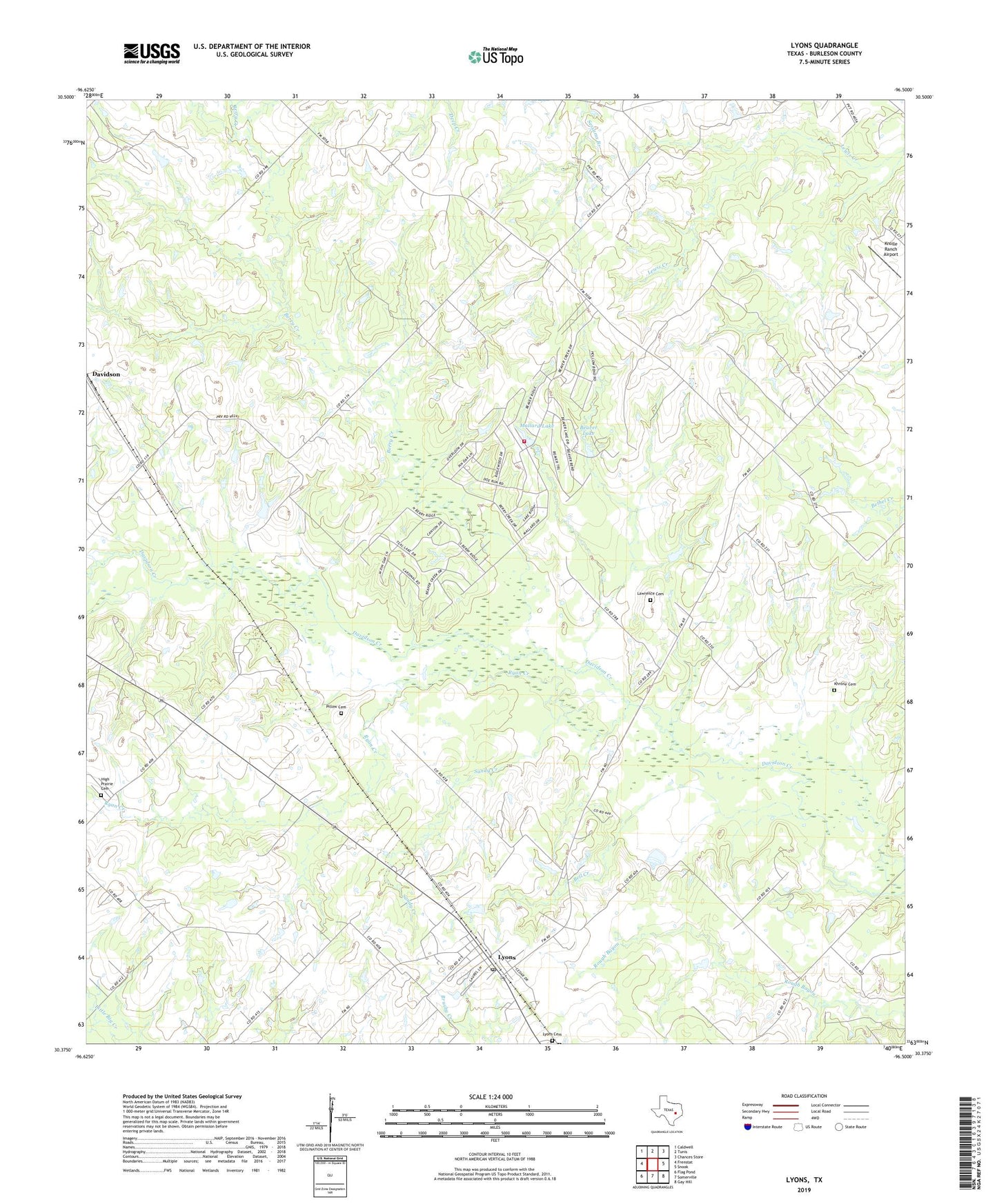
2019 topographic map quadrangle Lyons in the state of Texas. Scale: 1:24000. Based on the newly updated USGS 7.5' US Topo map series, this map is in the following counties: Burleson. The map contains contour data, water features, and other items you are used to seeing on USGS maps, but also has updated roads and other features. This is the next generation of topographic maps. Printed on high-quality waterproof paper with UV fade-resistant inks.
Quads adjacent to this one:
West: Frenstat
Northwest: Caldwell
North: Tunis
Northeast: Chances Store
East: Snook
Southeast: Gay Hill
South: Somerville
Southwest: Flag Pond
Contains the following named places: Beaver Creek, Beaver Creek Census Designated Place, Beaver Creek Development Dam Number 1, Beaver Creek Development Dam Number 3, Beaver Creek Volunteer Fire Department, Beaver Lake, Bell Creek, Berry Creek, Burleson County, Center Line, High Prairie Cemetery, Khrone Cemetery, Knolle Ranch Airport, Lawrence Cemetery, Lone Oak Church, Lyons, Lyons Cemetery, Lyons Census Designated Place, Lyons Post Office, Mallard Lake, Pillow Cemetery, Ryan Creek, Sandy Creek, Somerville Historical Museum