
MyTopo
Major Peak Texas US Topo Map
Couldn't load pickup availability
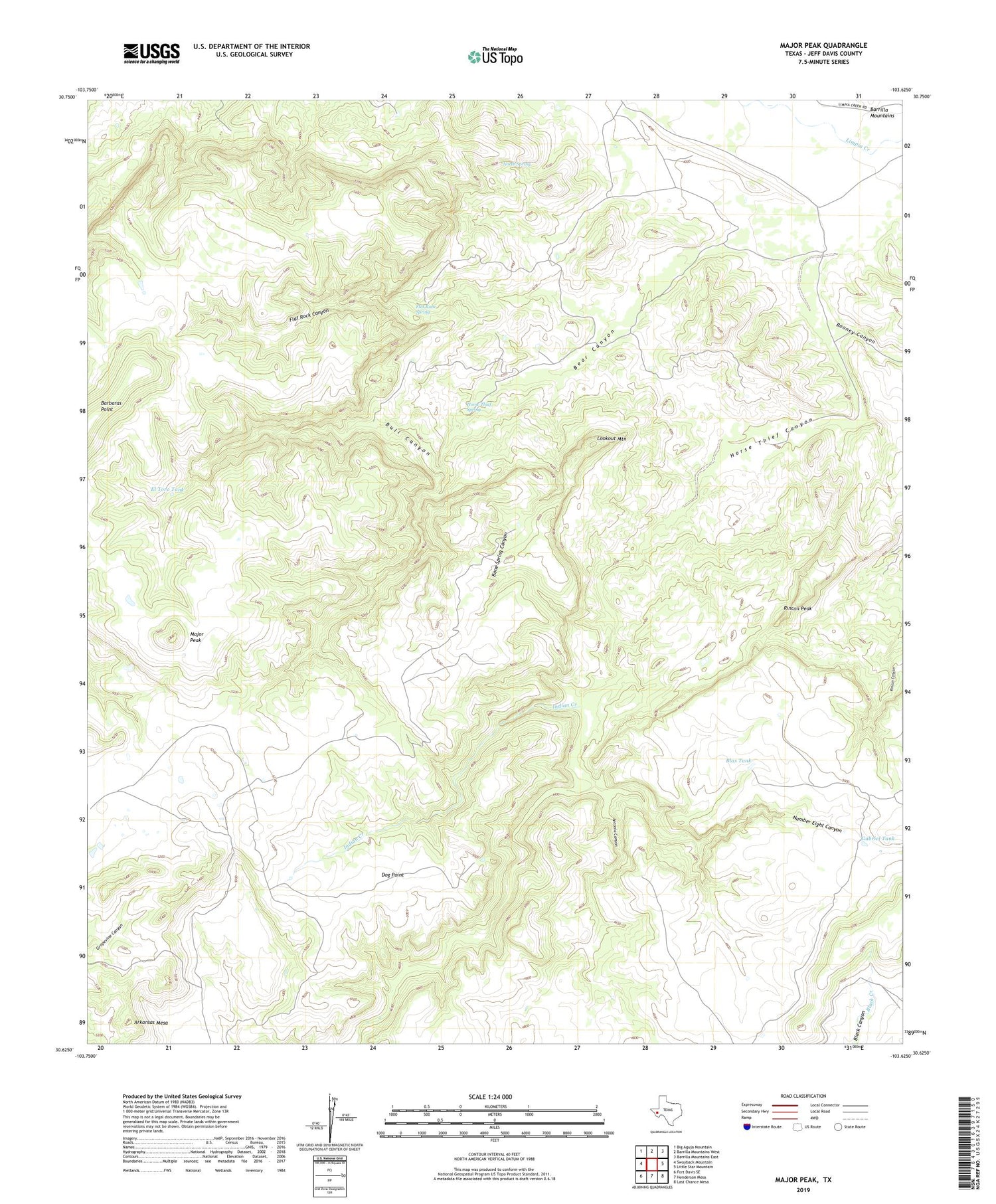
2019 topographic map quadrangle Major Peak in the state of Texas. Scale: 1:24000. Based on the newly updated USGS 7.5' US Topo map series, this map is in the following counties: Jeff Davis. The map contains contour data, water features, and other items you are used to seeing on USGS maps, but also has updated roads and other features. This is the next generation of topographic maps. Printed on high-quality waterproof paper with UV fade-resistant inks.
Quads adjacent to this one:
West: Swayback Mountain
Northwest: Big Aguja Mountain
North: Barrilla Mountains West
Northeast: Barrilla Mountains East
East: Little Star Mountain
Southeast: Last Chance Mesa
South: Henderson Mesa
Southwest: Fort Davis SE
Contains the following named places: Antonia Canyon, Barbaras Point, Bear Canyon, Blas Tank, Bone Spring Canyon, Bull Canyon, Dog Point, El Toro Tank, Flat Rock Canyon, Flat Rock Spring, Gabriel Tank, Horse Thief Spring, Indian Creek, Lookout Mountain, North Spring, Number Eight Canyon, Rincon Peak, Rooney Canyon, Saltlick Mill


