MyTopo
Little Star Mountain Texas US Topo Map
Couldn't load pickup availability
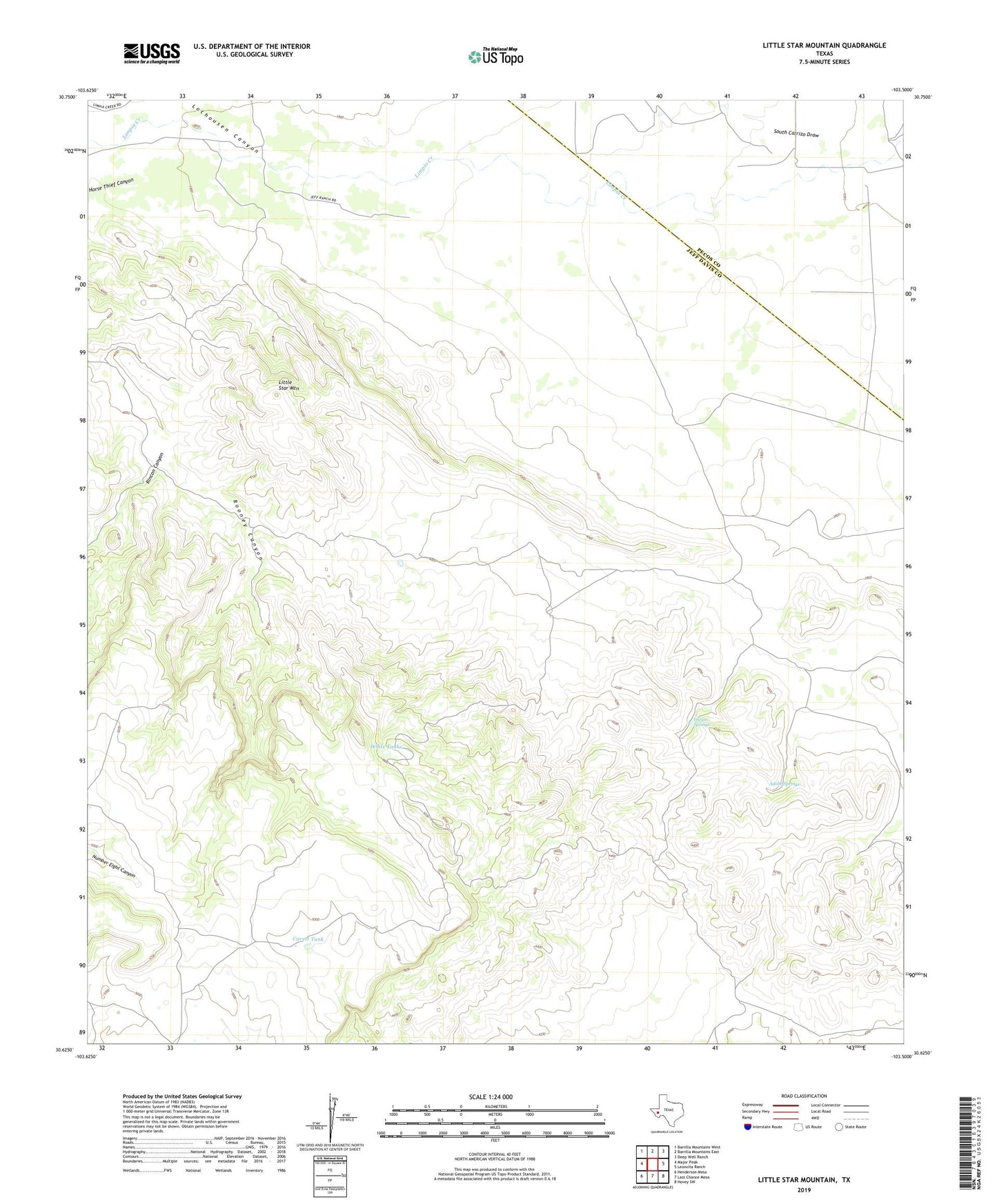
2022 topographic map quadrangle Little Star Mountain in the state of Texas. Scale: 1:24000. Based on the newly updated USGS 7.5' US Topo map series, this map is in the following counties: Jeff Davis, Pecos. The map contains contour data, water features, and other items you are used to seeing on USGS maps, but also has updated roads and other features. This is the next generation of topographic maps. Printed on high-quality waterproof paper with UV fade-resistant inks.
Quads adjacent to this one:
West: Major Peak
Northwest: Barrilla Mountains West
North: Barrilla Mountains East
Northeast: Deep Well Ranch
East: Leoncita Ranch
Southeast: Hovey SW
South: Last Chance Mesa
Southwest: Henderson Mesa
This map covers the same area as the classic USGS quad with code o30103f5.
Contains the following named places: Adobe Springs, Cavett Tank, Horse Thief Canyon, Indian Springs, Jeff Ranch, Little Star Mountain, Lochousen Canyon, Rincon Canyon, South Carrizo Draw, White Tanks