MyTopo
Markley Texas US Topo Map
Couldn't load pickup availability
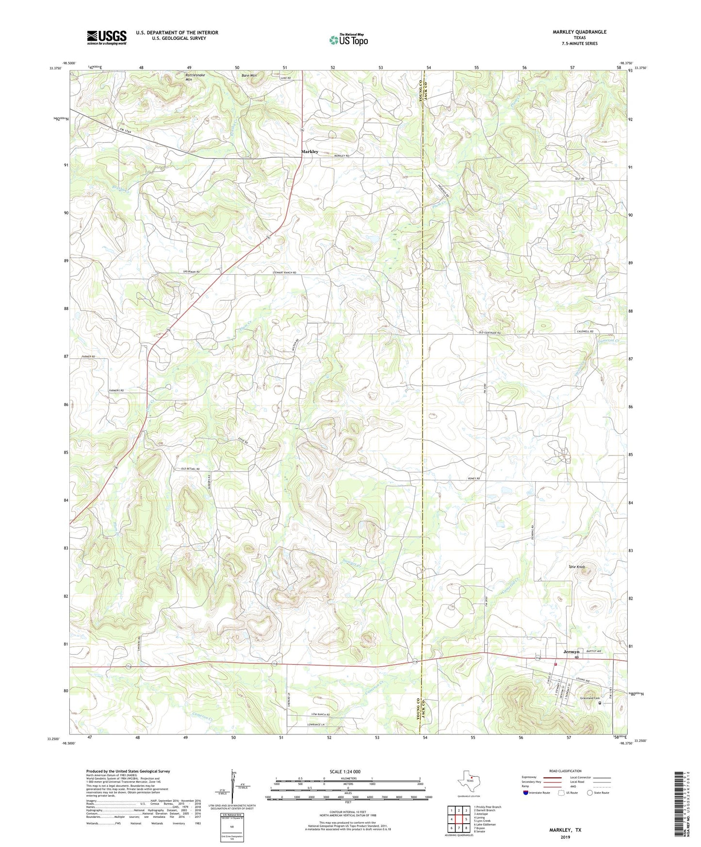
2019 topographic map quadrangle Markley in the state of Texas. Scale: 1:24000. Based on the newly updated USGS 7.5' US Topo map series, this map is in the following counties: Young, Jack. The map contains contour data, water features, and other items you are used to seeing on USGS maps, but also has updated roads and other features. This is the next generation of topographic maps. Printed on high-quality waterproof paper with UV fade-resistant inks.
Quads adjacent to this one:
West: Loving
Northwest: Prickly Pear Branch
North: Darnell Branch
Northeast: Antelope
East: Lynn Creek
Southeast: Senate
South: Bryson
Southwest: Lake Eddleman
Contains the following named places: Bare Mountain, Graceland Cemetery, Jermyn, Jermyn Post Office, Jermyn Volunteer Fire Department, Markley, Plum Grove Church, Rattlesnake Mountain, Spie Knob, Stewart Creek, Wilton Oil Field, ZIP Code: 76459