MyTopo
Martins Mill Texas US Topo Map
Couldn't load pickup availability
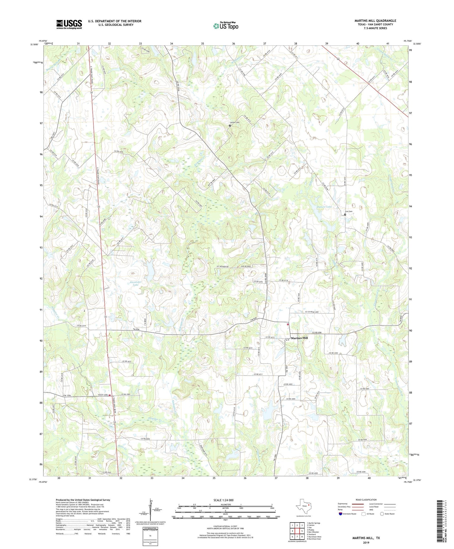
2019 topographic map quadrangle Martins Mill in the state of Texas. Scale: 1:24000. Based on the newly updated USGS 7.5' US Topo map series, this map is in the following counties: Van Zandt. The map contains contour data, water features, and other items you are used to seeing on USGS maps, but also has updated roads and other features. This is the next generation of topographic maps. Printed on high-quality waterproof paper with UV fade-resistant inks.
Quads adjacent to this one:
West: Phalba
Northwest: Myrtle Springs
North: Canton
Northeast: Van
East: Ben Wheeler
Southeast: Murchison East
South: Murchison West
Southwest: Stockard
Contains the following named places: Alexander Lake, Alexander Lake Dam, Alligator Creek, Carter Cemetery, China Grove School, Cool Springs Church, Cox Cemetery, Dubose Dam, Dubose Lake, Hobbs Church, Holly Springs, Little Hope Church, Lowrie Lake, Lowrie Lake Dam, Martins Mill, Pleasant Hill Church, Sand Branch, South Van Zandt Volunteer Fire Department Station 1, South Van Zandt Volunteer Fire Department Station 2, Steve Creek, Walnut Spring Church