MyTopo
Murchison West Texas US Topo Map
Couldn't load pickup availability
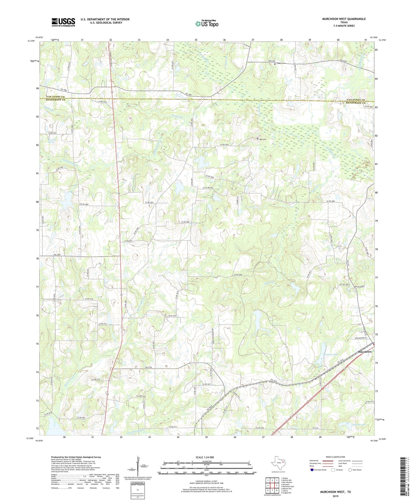
2022 topographic map quadrangle Murchison West in the state of Texas. Scale: 1:24000. Based on the newly updated USGS 7.5' US Topo map series, this map is in the following counties: Henderson, Van Zandt. The map contains contour data, water features, and other items you are used to seeing on USGS maps, but also has updated roads and other features. This is the next generation of topographic maps. Printed on high-quality waterproof paper with UV fade-resistant inks.
Quads adjacent to this one:
West: Stockard
Northwest: Phalba
North: Martins Mill
Northeast: Ben Wheeler
East: Murchison East
Southeast: Leagueville
South: Athens
Southwest: Mallard Hill
Contains the following named places: Ash School, Bethel, Bethel Church, Bethel School, City of Murchison, Coppers Branch, Cox Chapel, Cox Lake, Cox Lake Dam, Cream Level Creek, Daniel Creek, Diffy Creek, Dillard Lake, Dillard Lake Dam, Dragert Lake, Dragert Lake Dam, Drakes Branch, Jackson Lake, Lee Lake, Lee Lake Dam, Liberty Cemetery, Martins Mills School, Meredith Spring, Meridith Church, Murchison City Hall, Murchison Volunteer Fire Department, N M Jackson Dam, Pottawatomie Church, Pottawatomie Creek, Ray Cemetery, Stepp Airport, Sumer Hill, Tidmore Cemetery, Tiner Lake, Tiner Lake Dam, Walton, Walton School