MyTopo
Phalba Texas US Topo Map
Couldn't load pickup availability
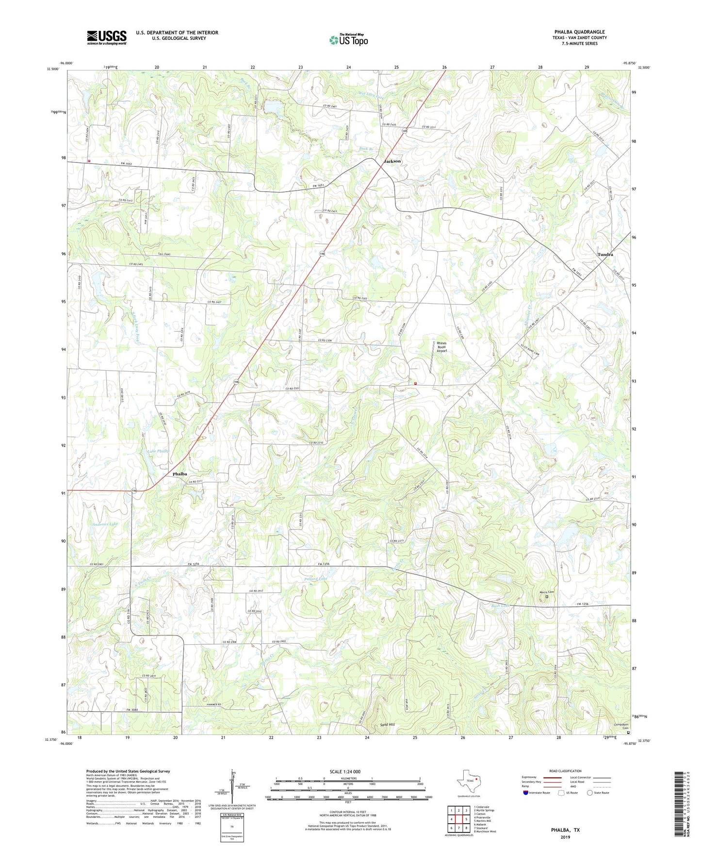
2022 topographic map quadrangle Phalba in the state of Texas. Scale: 1:24000. Based on the newly updated USGS 7.5' US Topo map series, this map is in the following counties: Van Zandt. The map contains contour data, water features, and other items you are used to seeing on USGS maps, but also has updated roads and other features. This is the next generation of topographic maps. Printed on high-quality waterproof paper with UV fade-resistant inks.
Quads adjacent to this one:
West: Prairieville
Northwest: Cedarvale
North: Myrtle Springs
Northeast: Canton
East: Martins Mill
Southeast: Murchison West
South: Stockard
Southwest: Mabank
This map covers the same area as the classic USGS quad with code o32095d8.
Contains the following named places: Andrews Lake, Bethel Church, Bethel School, Big Rock Church, Big Rock School, Bush Lake, Cedar Creek Lake Division, Charles Napper Lake, Charles Napper Lake Dam, Denman Crossroads, Jackson, Lake Phalba, Lone Star School, Morris Cemetery, Phalba, Phalba School, Pleasant Glade School, Pollard Lake, Rhines Roost Airport, Rock Hill School, Sand Hill, Soil Conservation Service Site 134 Dam, Soil Conservation Service Site 134 Reservoir, Soil Conservation Service Site 135b Dam, Soil Conservation Service Site 135b Reservoir, South Van Zandt Volunteer Fire Department Station 3, Southwest Van Zandt Division, Tundra, Whitton, Whitton Volunteer Fire Department