MyTopo
Masterson Texas US Topo Map
Couldn't load pickup availability
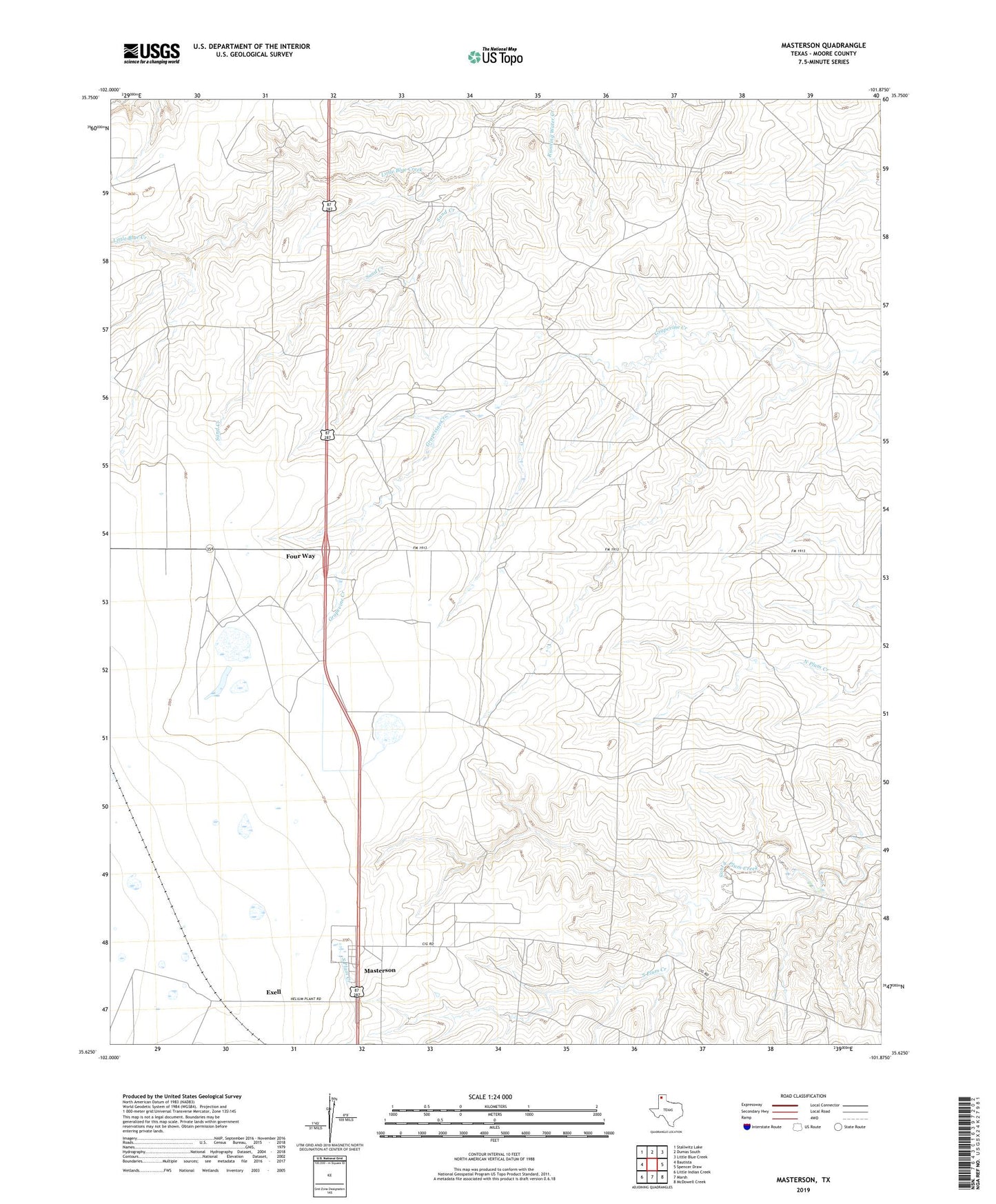
2022 topographic map quadrangle Masterson in the state of Texas. Scale: 1:24000. Based on the newly updated USGS 7.5' US Topo map series, this map is in the following counties: Moore. The map contains contour data, water features, and other items you are used to seeing on USGS maps, but also has updated roads and other features. This is the next generation of topographic maps. Printed on high-quality waterproof paper with UV fade-resistant inks.
Quads adjacent to this one:
West: Bautista
Northwest: Stallwitz Lake
North: Dumas South
Northeast: Little Blue Creek
East: Spencer Draw
Southeast: McDowell Creek
South: Marsh
Southwest: Little Indian Creek
This map covers the same area as the classic USGS quad with code o35101f8.
Contains the following named places: Bivins Compressor Station, Brent Ranch, Exell, Four Way, Little Blue Creek, Masterson, Phillip Thompson Ranch, Sand Creek, Terry Thompson Ranch