MyTopo
Mauriceville Texas US Topo Map
Couldn't load pickup availability
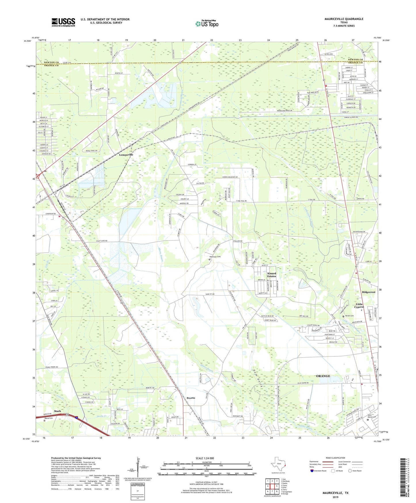
2019 topographic map quadrangle Mauriceville in the state of Texas. Scale: 1:24000. Based on the newly updated USGS 7.5' US Topo map series, this map is in the following counties: Orange, Newton. The map contains contour data, water features, and other items you are used to seeing on USGS maps, but also has updated roads and other features. This is the next generation of topographic maps. Printed on high-quality waterproof paper with UV fade-resistant inks.
Quads adjacent to this one:
West: Texla
Northwest: Gist
North: Hartburg
Northeast: Starks
East: Echo
Southeast: Orange
South: Orangefield
Southwest: Terry
Contains the following named places: Bland Cemetery, Coughlin, First Baptist Church, First Church of the Nazarene, Forest Heights, Forest Heights Census Designated Place, Gratis, Gum Gully, Kinard Estates, KKMY-FM (Orange), KOGT-AM (Orange), KTXB-FM (Beaumont), Lemonville, Little Cypress, Little Cypress - Mauriceville High School, Little Cypress Census Designated Place, Little Cypress Elementary School, Little Cypress Fire - Rescue Department Station 1, Little Cypress Fire - Rescue Department Station 2, Little Cypress Intermediate School, Little Cypress School, Mauriceville, Mauriceville Division, Mauriceville Post Office, Mauriceville Volunteer Fire Department, Orange Fire Department Station 2, Parish Cemetery, Peveto, Reese, Saint Marys Cemetery, Stark, Wilkinson Cemetery, ZIP Code: 77632