MyTopo
Terry Texas US Topo Map
Couldn't load pickup availability
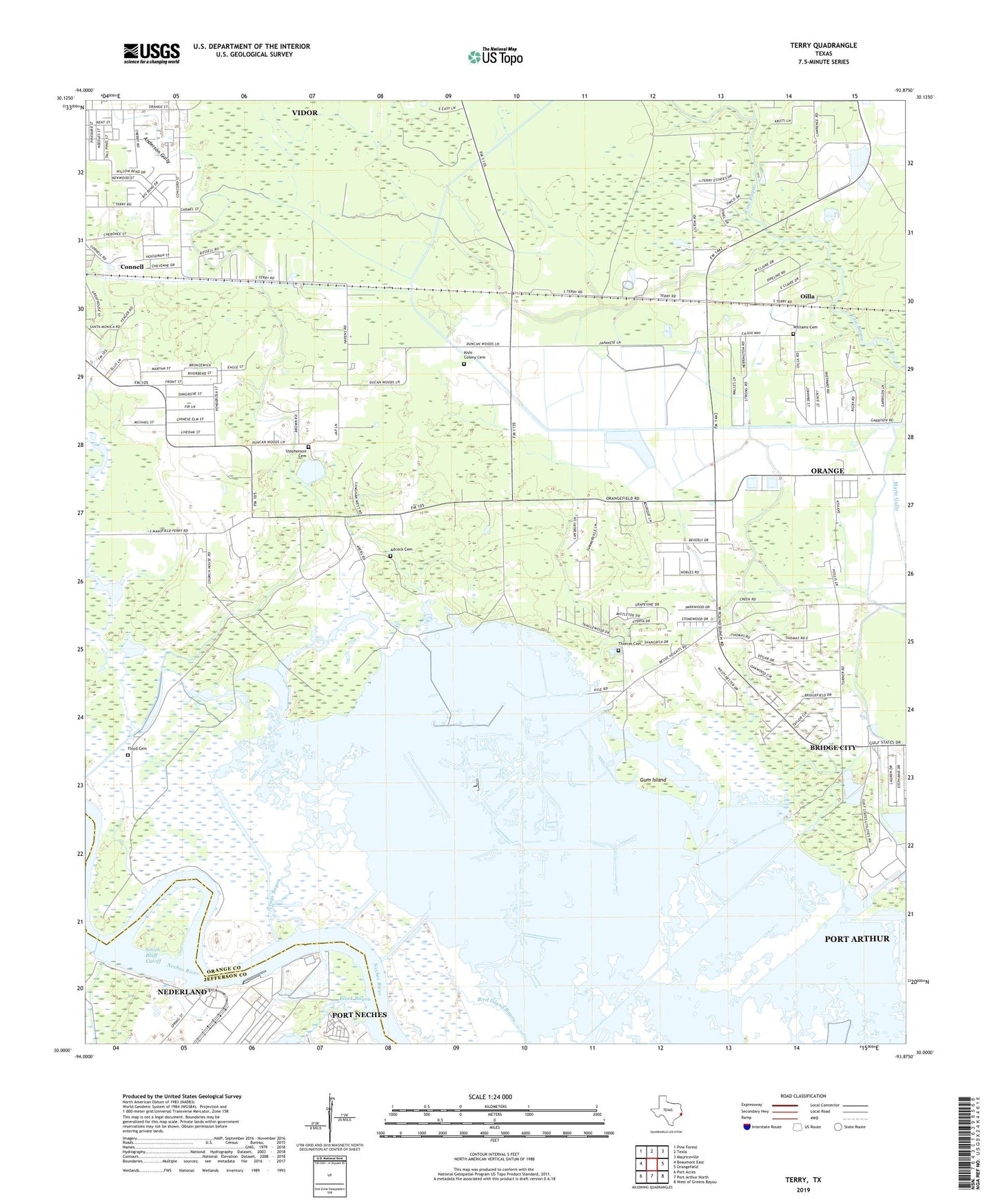
2022 topographic map quadrangle Terry in the state of Texas. Scale: 1:24000. Based on the newly updated USGS 7.5' US Topo map series, this map is in the following counties: Orange, Jefferson. The map contains contour data, water features, and other items you are used to seeing on USGS maps, but also has updated roads and other features. This is the next generation of topographic maps. Printed on high-quality waterproof paper with UV fade-resistant inks.
Quads adjacent to this one:
West: Beaumont East
Northwest: Pine Forest
North: Texla
Northeast: Mauriceville
East: Orangefield
Southeast: West of Greens Bayou
South: Port Arthur North
Southwest: Port Acres
This map covers the same area as the classic USGS quad with code o30093a8.
Contains the following named places: Adcock Cemetery, Bessie Heights, Bessie Heights Oil and Gas Field, Block Bayou, Bridge City-Orangefield Division, Connell, Floyd Cemetery, Grays Bayou, Gum Island, KDLF-AM (Port Neches), KDVE-AM (Nederland), Kishi Colony Cemetery, KTFA-FM (Groves), KYKR-FM (Port Arthur), Lower Neches Wildlife Management Area - Bessie Height, North Port Neches Oil and Gas Field, Oak Bluff Memorial Park, Oilla, Orange County, Smith Bluff Cutoff, Stephenson Cemetery, Terry, Williams Cemetery