MyTopo
Texla Texas US Topo Map
Couldn't load pickup availability
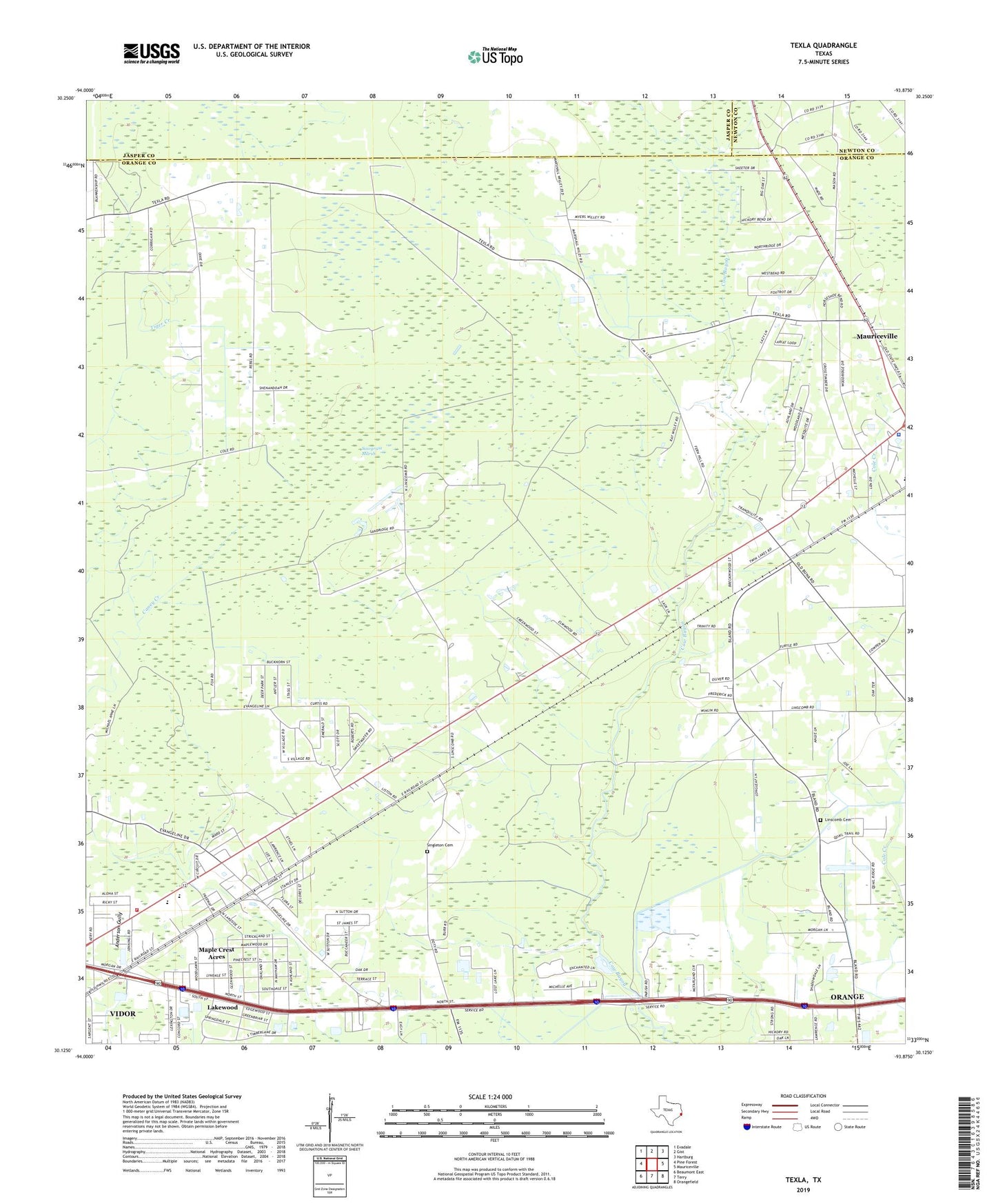
2022 topographic map quadrangle Texla in the state of Texas. Scale: 1:24000. Based on the newly updated USGS 7.5' US Topo map series, this map is in the following counties: Orange, Jasper, Newton. The map contains contour data, water features, and other items you are used to seeing on USGS maps, but also has updated roads and other features. This is the next generation of topographic maps. Printed on high-quality waterproof paper with UV fade-resistant inks.
Quads adjacent to this one:
West: Pine Forest
Northwest: Evadale
North: Gist
Northeast: Hartburg
East: Mauriceville
Southeast: Orangefield
South: Terry
Southwest: Beaumont East
This map covers the same area as the classic USGS quad with code o30093b8.
Contains the following named places: Allegiance Emergency Services District 1 Station 1, Central Baptist Church, City of Vidor, Doty, Faith Tabernacle Pentecostal Church, Harmony Baptist Church, Jenkins Airport, KAYD-FM (Beaumont), KBMT-TV (Beaumont), KFDM-TV (Beaumont), KIOC-FM (Orange), KITU-TV (Beaumont), KJAC-TV (Port Arthur), KKMY-FM (Orange), KQXY-FM (Beaumont), KZZB-FM (Beaumont), Lakewood, Linscomb Cemetery, Log Cabin Tabernacle, Maple Crest Acres, Mauriceville Census Designated Place, Oak Forest Elementary School, Orange County Sheriff's Office - Mauriceville, Sawgrass Marsh, Singleton Cemetery, Texla, Trinity Baptist Church, United Church, Vidor Middle School