MyTopo
McMahan Texas US Topo Map
Couldn't load pickup availability
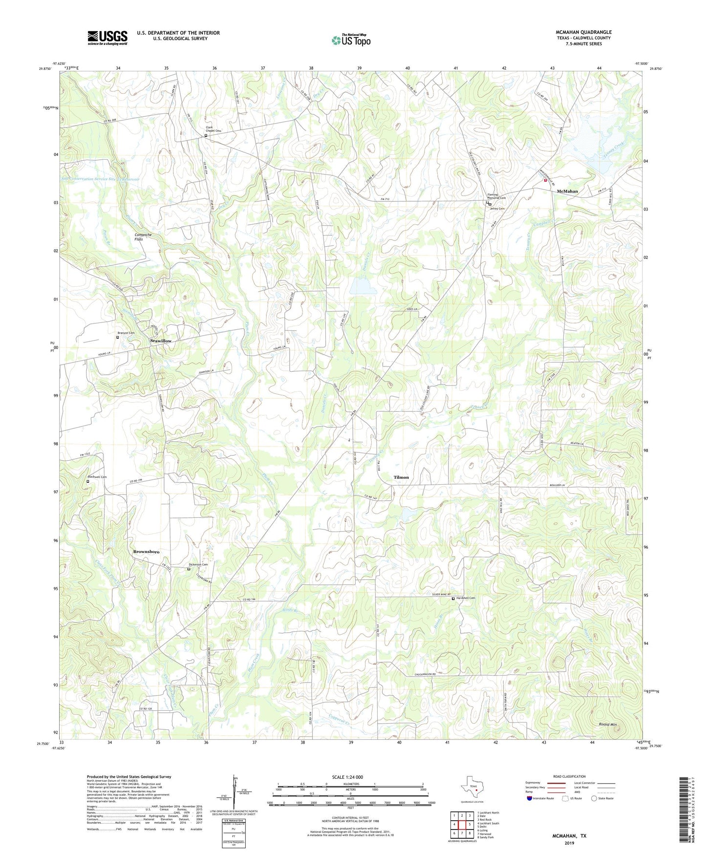
2019 topographic map quadrangle McMahan in the state of Texas. Scale: 1:24000. Based on the newly updated USGS 7.5' US Topo map series, this map is in the following counties: Caldwell. The map contains contour data, water features, and other items you are used to seeing on USGS maps, but also has updated roads and other features. This is the next generation of topographic maps. Printed on high-quality waterproof paper with UV fade-resistant inks.
Quads adjacent to this one:
West: Lockhart South
Northwest: Lockhart North
North: Dale
Northeast: Red Rock
East: Delhi
Southeast: Sandy Fork
South: Harwood
Southwest: Luling
Contains the following named places: Bethel Church, Blackwell Cemetery, Branyon Cemetery, Branyon Oil Field, Brownsboro, Caldwell County, Campbell Creek, Clark Chapel Cemetery, Clear Fork Church, Clear Fork Plum Creek, Comanche Flats, Copperas Creek, Daniels Chapel, Daniels Creek, Dickerson Cemetery, Dry Creek, Fleming Memorial Cemetery, Hardshell Cemetery, Hines Branch, Jefrey Cemetery, Linscome Creek, McMahan, Mcmahan Baptist Church, McMahan Volunteer Fire Department, Pecan Branch, Round Mountain, Seawillow, Site Number Twentyeight, Sixmile Branch, Soil Conservation Service Site 27 Dam, Soil Conservation Service Site 27 Reservoir, Soil Conservation Service Site 28 Dam, Soil Conservation Service Site 28 Reservoir, Soil Conservation Service Site 31 Dam, Soil Conservation Service Site 31 Reservoir, Tenney Creek, Tenney Creek Church, Tenney Creek Oil Field, Tilmon, Watts