MyTopo
Menard Texas US Topo Map
Couldn't load pickup availability
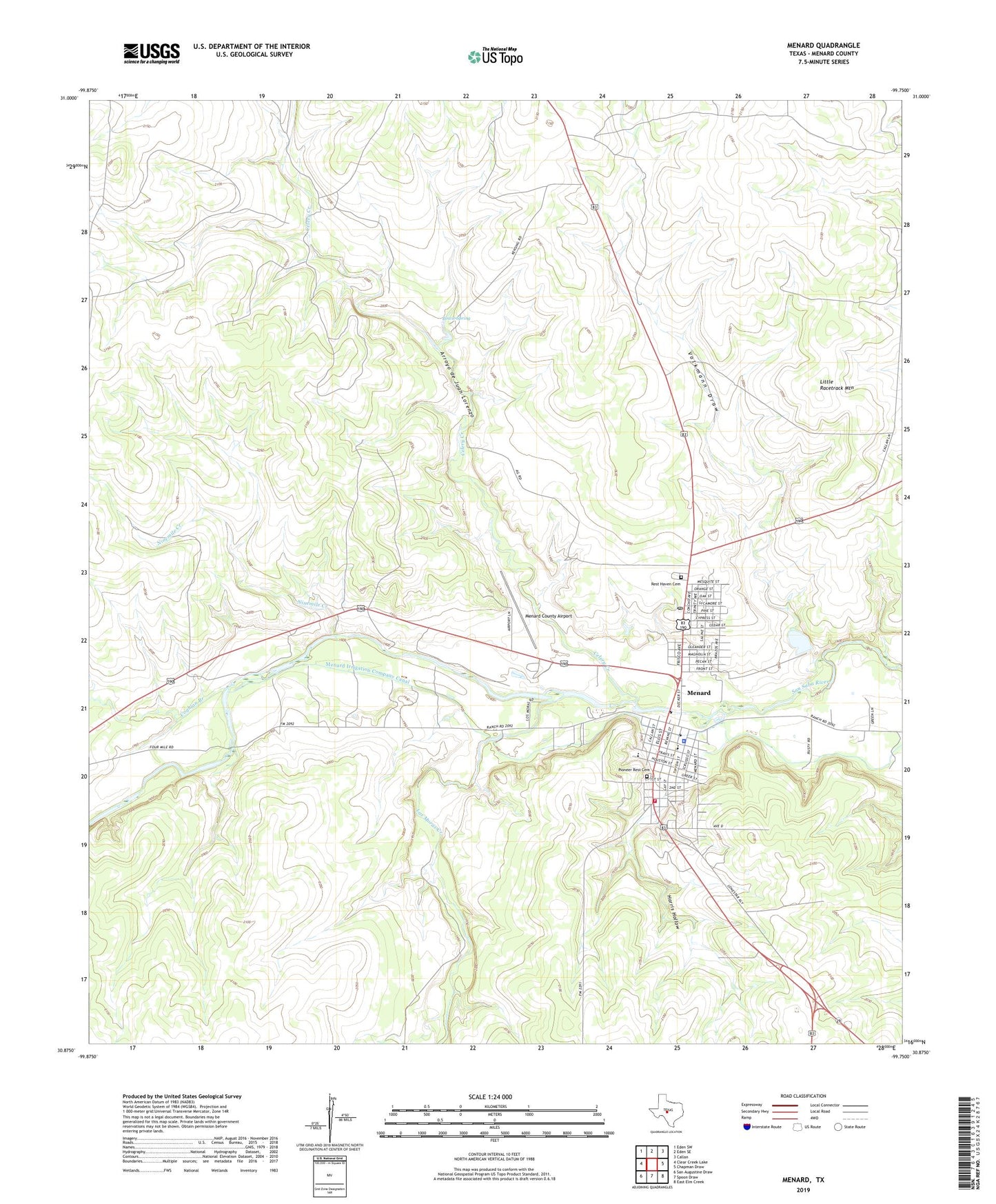
2019 topographic map quadrangle Menard in the state of Texas. Scale: 1:24000. Based on the newly updated USGS 7.5' US Topo map series, this map is in the following counties: Menard. The map contains contour data, water features, and other items you are used to seeing on USGS maps, but also has updated roads and other features. This is the next generation of topographic maps. Printed on high-quality waterproof paper with UV fade-resistant inks.
Quads adjacent to this one:
West: Clear Creek Lake
Northwest: Eden SW
North: Eden SE
Northeast: Callan
East: Chapman Draw
Southeast: East Elm Creek
South: Spoon Draw
Southwest: San Augustine Draw
Contains the following named places: Arroyo de Juan Lorenzo, Bowie Spring, Celery Creek, City of Menard, Coghlan Branch, Fourmile Crossing, Garden of Memories Cemetery, Harris Hollow, Las Moras Creek, Little Racetrack Mountain, Menard, Menard City Hall, Menard County, Menard County Airport, Menard County Jail, Menard County Museum, Menard County Sheriff's Office, Menard Elementary - Middle School, Menard Elementary School, Menard Emergency Service Ambulance, Menard High School, Menard Irrigation Company Canal, Menard Post Office, Menard Volunteer Fire Department, Mission San Saba, Ninemile Creek, Pioneer Rest Cemetery, Rest Haven Cemetery, Sacred Heart Catholic Cemetery, San Saba Mission, Volkmann Draw, ZIP Code: 76859