MyTopo
Minter Texas US Topo Map
Couldn't load pickup availability
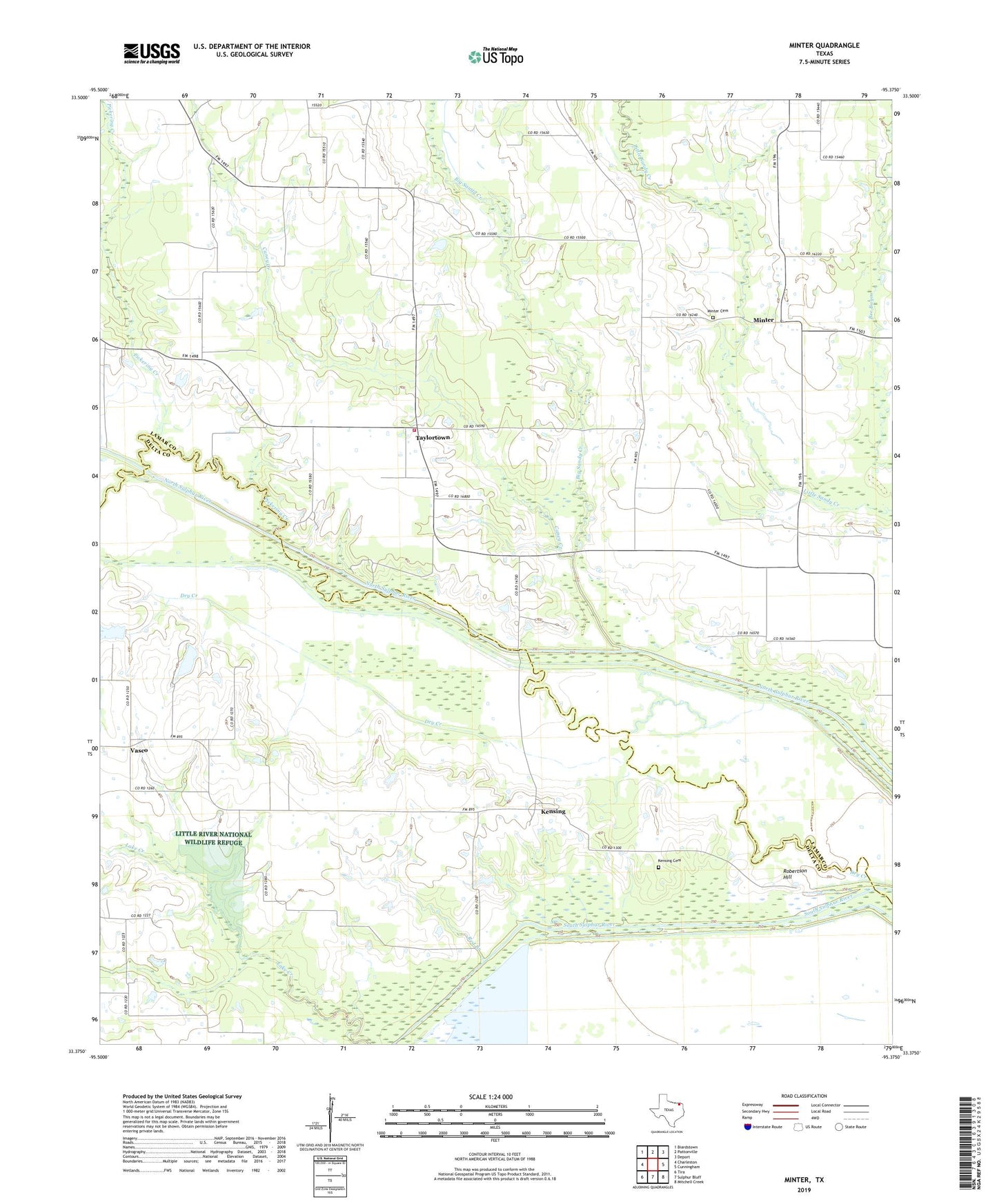
2019 topographic map quadrangle Minter in the state of Texas. Scale: 1:24000. Based on the newly updated USGS 7.5' US Topo map series, this map is in the following counties: Lamar, Delta. The map contains contour data, water features, and other items you are used to seeing on USGS maps, but also has updated roads and other features. This is the next generation of topographic maps. Printed on high-quality waterproof paper with UV fade-resistant inks.
Quads adjacent to this one:
West: Charleston
Northwest: Biardstown
North: Pattonville
Northeast: Deport
East: Cunningham
Southeast: Mitchell Creek
South: Sulphur Bluff
Southwest: Tira
Contains the following named places: Bethlehem Church, Big Sandy Creek, Bozman Dam, Bozman Lake, Caney Creek, Dry Creek, Kensing, Kensing Cemetery, Minter, Minter Cemetery, Pickering Creek, Red Branch, Robertson Hill, Rock Ford, Rockford Church, Taylortown, Taylortown Volunteer Fire Department, Union Church, Vasco, ZIP Code: 75450