MyTopo
Mitchell Creek Texas US Topo Map
Couldn't load pickup availability
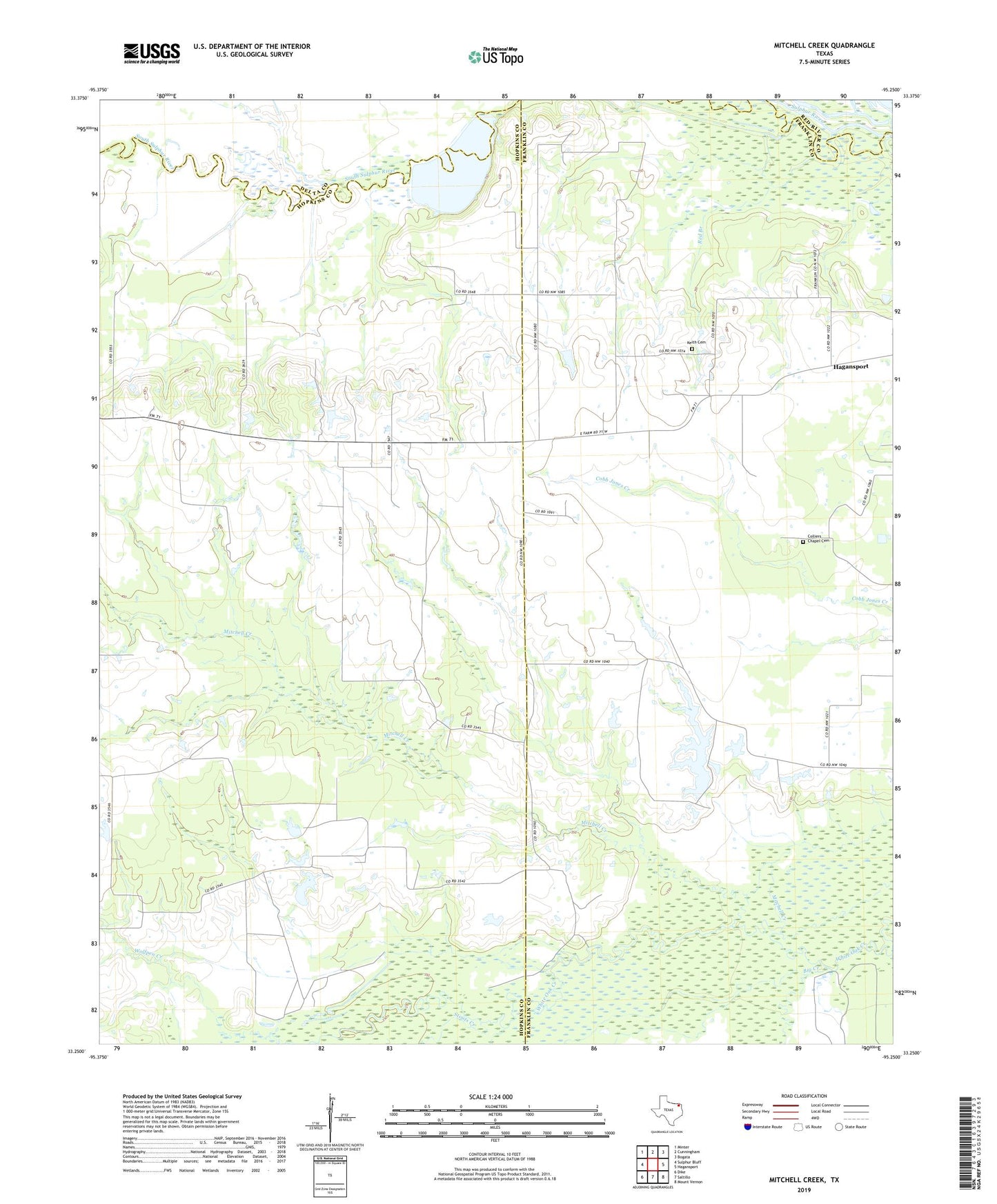
2022 topographic map quadrangle Mitchell Creek in the state of Texas. Scale: 1:24000. Based on the newly updated USGS 7.5' US Topo map series, this map is in the following counties: Hopkins, Franklin, Delta, Red River. The map contains contour data, water features, and other items you are used to seeing on USGS maps, but also has updated roads and other features. This is the next generation of topographic maps. Printed on high-quality waterproof paper with UV fade-resistant inks.
Quads adjacent to this one:
West: Sulphur Bluff
Northwest: Minter
North: Cunningham
Northeast: Bogata
East: Hagansport
Southeast: Mount Vernon
South: Saltillo
Southwest: Dike
This map covers the same area as the classic USGS quad with code o33095c3.
Contains the following named places: Adonia Church, Big Creek, Colliers Chapel Cemetery, Eureka, Fairview Church, Keith Cemetery, Mitchell Creek, Oakdale, Paradise Lake, Paradise Lake Dam, Red Branch, Shell Oil Field, Stouts Creek, Wolfpen Creek, ZIP Code: 75481