
MyTopo
Mosquito Point Texas US Topo Map
Couldn't load pickup availability
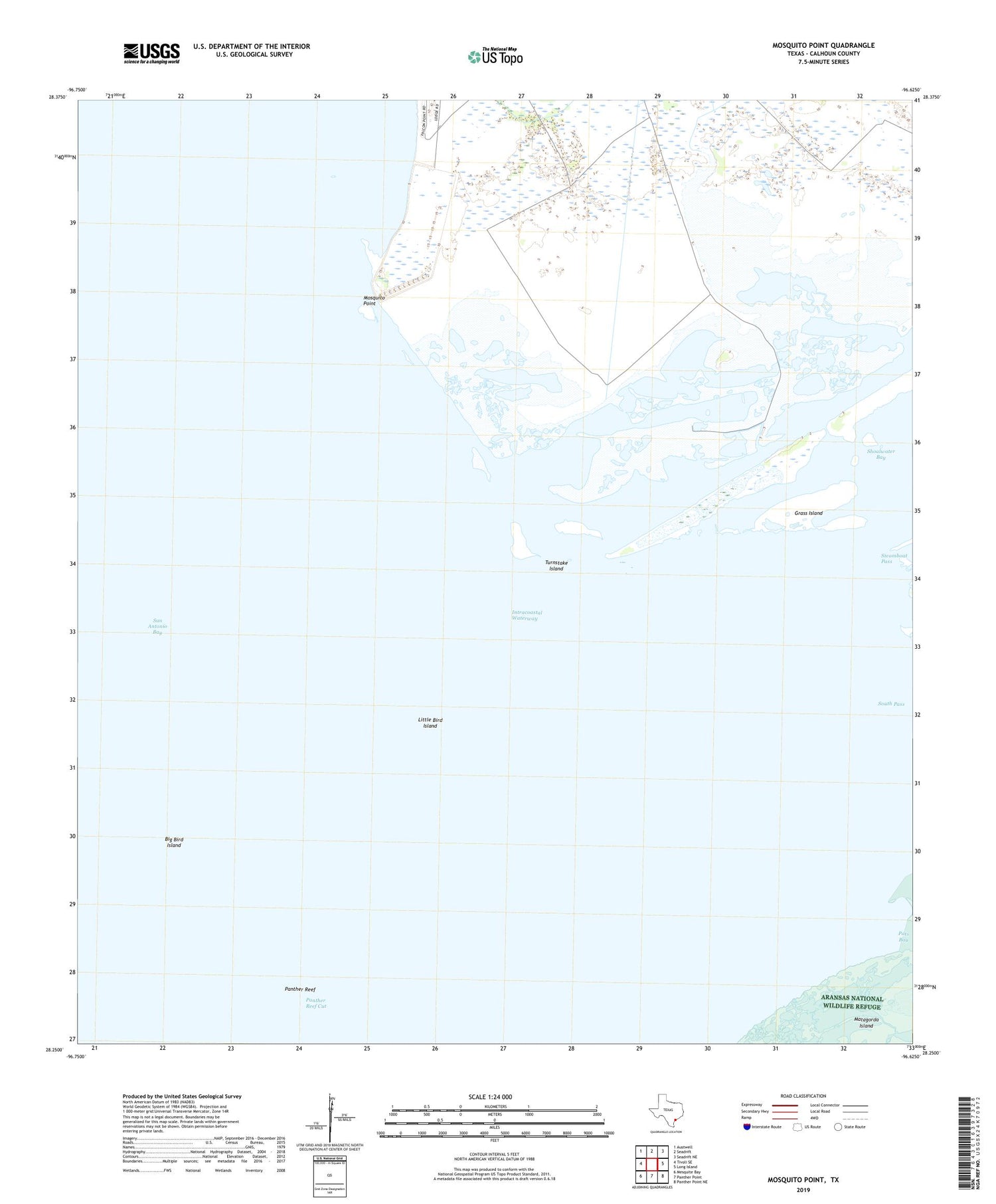
2019 topographic map quadrangle Mosquito Point in the state of Texas. Scale: 1:24000. Based on the newly updated USGS 7.5' US Topo map series, this map is in the following counties: Calhoun. The map contains contour data, water features, and other items you are used to seeing on USGS maps, but also has updated roads and other features. This is the next generation of topographic maps. Printed on high-quality waterproof paper with UV fade-resistant inks.
Quads adjacent to this one:
West: Tivoli SE
Northwest: Austwell
North: Seadrift
Northeast: Seadrift NE
East: Long Island
Southeast: Panther Point NE
South: Panther Point
Southwest: Mesquite Bay
Contains the following named places: Big Bird Island, Grass Island, Little Bird Island, Mosquito Point, Panther Reef Cut, San Antonio Bay, Seadrift Division, Turnstake Island, Welder Flats Wildlife Management Area


