MyTopo
Mesquite Bay Texas US Topo Map
Couldn't load pickup availability
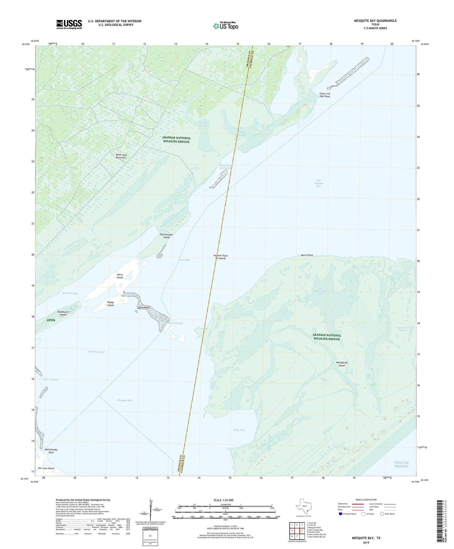
2025 topographic map quadrangle Mesquite Bay in the state of Texas. Scale: 1:24000. Based on the newly updated USGS 7.5' US Topo map series, this map is in the following counties: Calhoun, Aransas. The map contains contour data, water features, and other items you are used to seeing on USGS maps, but also has updated roads and other features. This is the next generation of topographic maps. Printed on high-quality waterproof paper with UV fade-resistant inks.
Quads adjacent to this one:
West: Saint Charles Bay
Northwest: Tivoli SW
North: Tivoli SE
Northeast: Mosquito Point
East: Panther Point
South: Saint Charles Bay SE
Southwest: Saint Charles Bay SW
This map covers the same area as the classic USGS quad with code o28096b7.
Contains the following named places: Ayres Bay, Ayres Dugout, Ayres Island, Ayres Point, Ayres Reef, Belden Dugout, Big Brundrett Lake, Bray Cove, Carlos Windmill, Cottonwood Bayou, False Live Oak Point, Jack Windmill, Little Brundrett Lake, Long Lake, McMullen Lake, Mesquite Bay, Mustang Lake, Mustang Slough, Rattlesnake Island, Rattlesnake Reef, Redfish Slough, Roddy Island, Second Chain of Islands, Shell Reef Bayou, Sundown Bay, Third Chain of Islands