MyTopo
Seadrift NE Texas US Topo Map
Couldn't load pickup availability
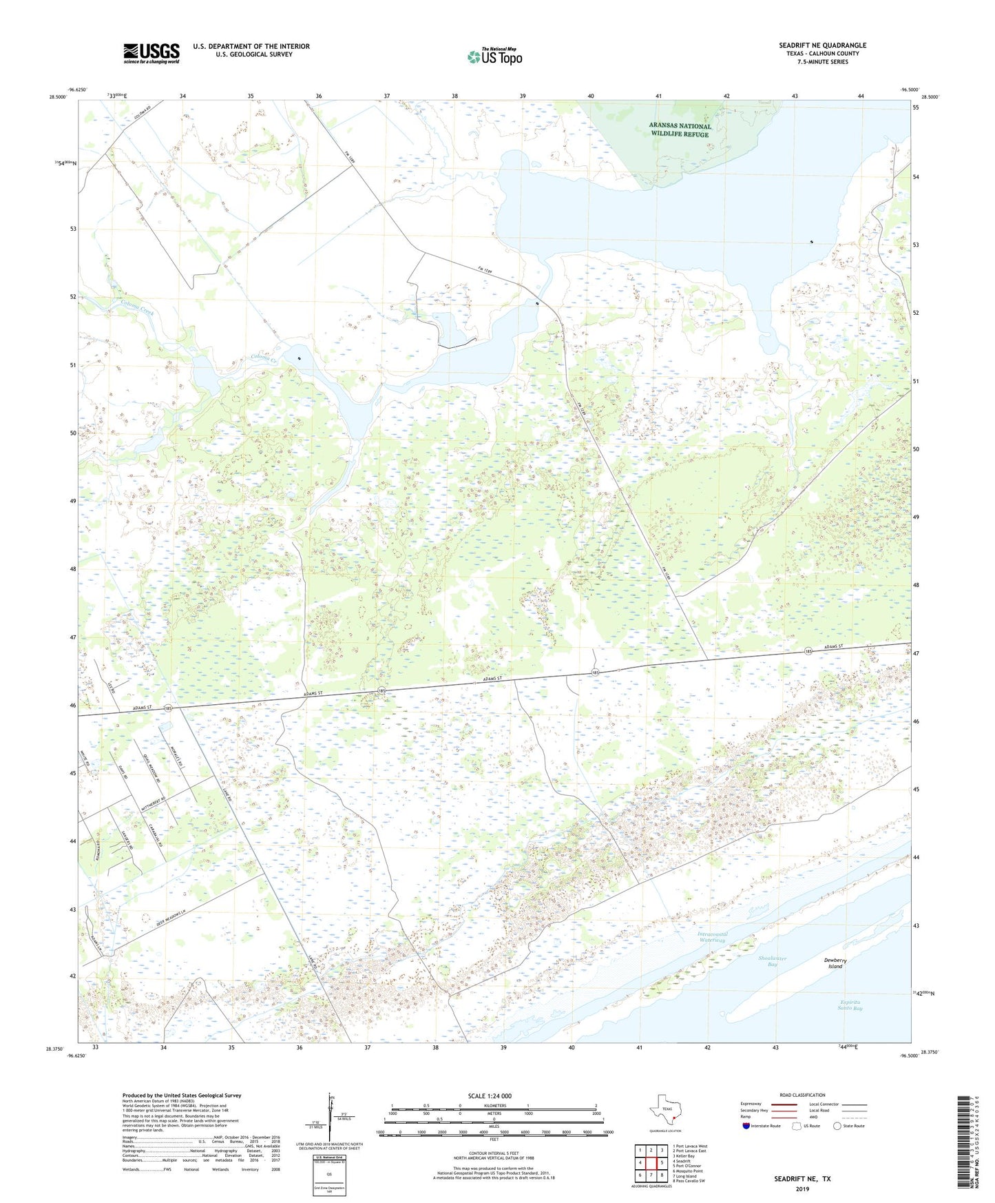
2022 topographic map quadrangle Seadrift NE in the state of Texas. Scale: 1:24000. Based on the newly updated USGS 7.5' US Topo map series, this map is in the following counties: Calhoun. The map contains contour data, water features, and other items you are used to seeing on USGS maps, but also has updated roads and other features. This is the next generation of topographic maps. Printed on high-quality waterproof paper with UV fade-resistant inks.
Quads adjacent to this one:
West: Seadrift
Northwest: Port Lavaca West
North: Port Lavaca East
Northeast: Keller Bay
Southeast: Pass Cavallo SW
South: Long Island
Southwest: Mosquito Point
This map covers the same area as the classic USGS quad with code o28096d5.
Contains the following named places: Calhoun County, Coloma Creek, Dewberry Island, Middle Sandy Creek, Powderhorn Lake, Powderhorn Lake Oil Field, ZIP Code: 77983