MyTopo
Mountain Pass Texas US Topo Map
Couldn't load pickup availability
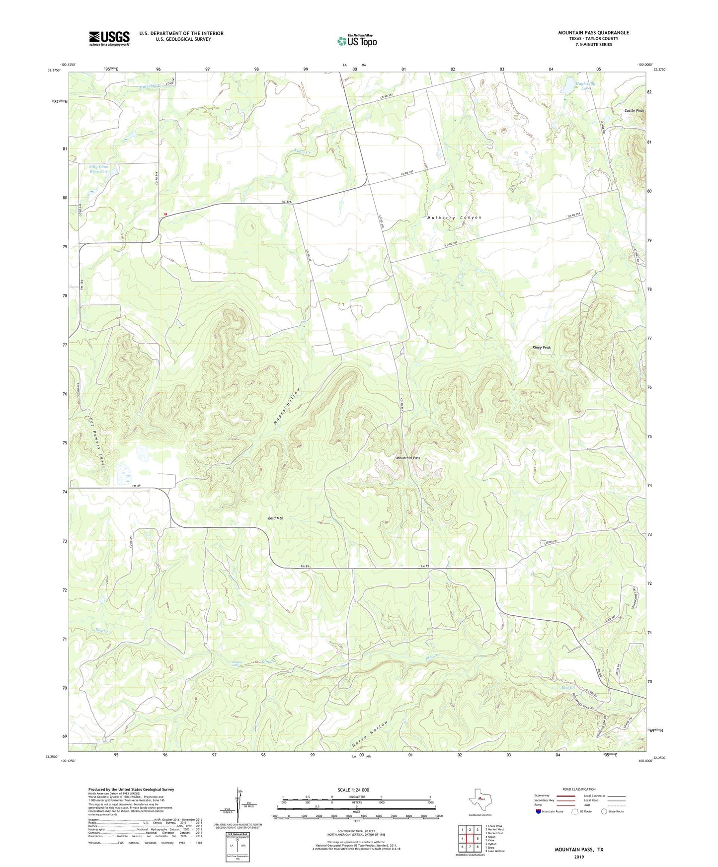
2019 topographic map quadrangle Mountain Pass in the state of Texas. Scale: 1:24000. Based on the newly updated USGS 7.5' US Topo map series, this map is in the following counties: Taylor. The map contains contour data, water features, and other items you are used to seeing on USGS maps, but also has updated roads and other features. This is the next generation of topographic maps. Printed on high-quality waterproof paper with UV fade-resistant inks.
Quads adjacent to this one:
West: Nolan
Northwest: Chalk Peak
North: Merkel West
Northeast: Merkel East
East: View
Southeast: Lake Abilene
South: Shep
Southwest: Hylton
Contains the following named places: Bald Mountain, Billy Doan Dam, Billy Doan Reservoir, Butman Camp, Butman Falls, Dudley Cemetery, Horse Hollow, Hugh Lilly Lake, Hugh Lilly Lake Dam, Mapes Hollow, Mountain Pass, Mulberry Canyon Volunteer Fire Department, Pat Powers Cove, Pioneer Church, Rhodes Ranch, Riney Peak, Weaver Springs Creek