MyTopo
Merkel West Texas US Topo Map
Couldn't load pickup availability
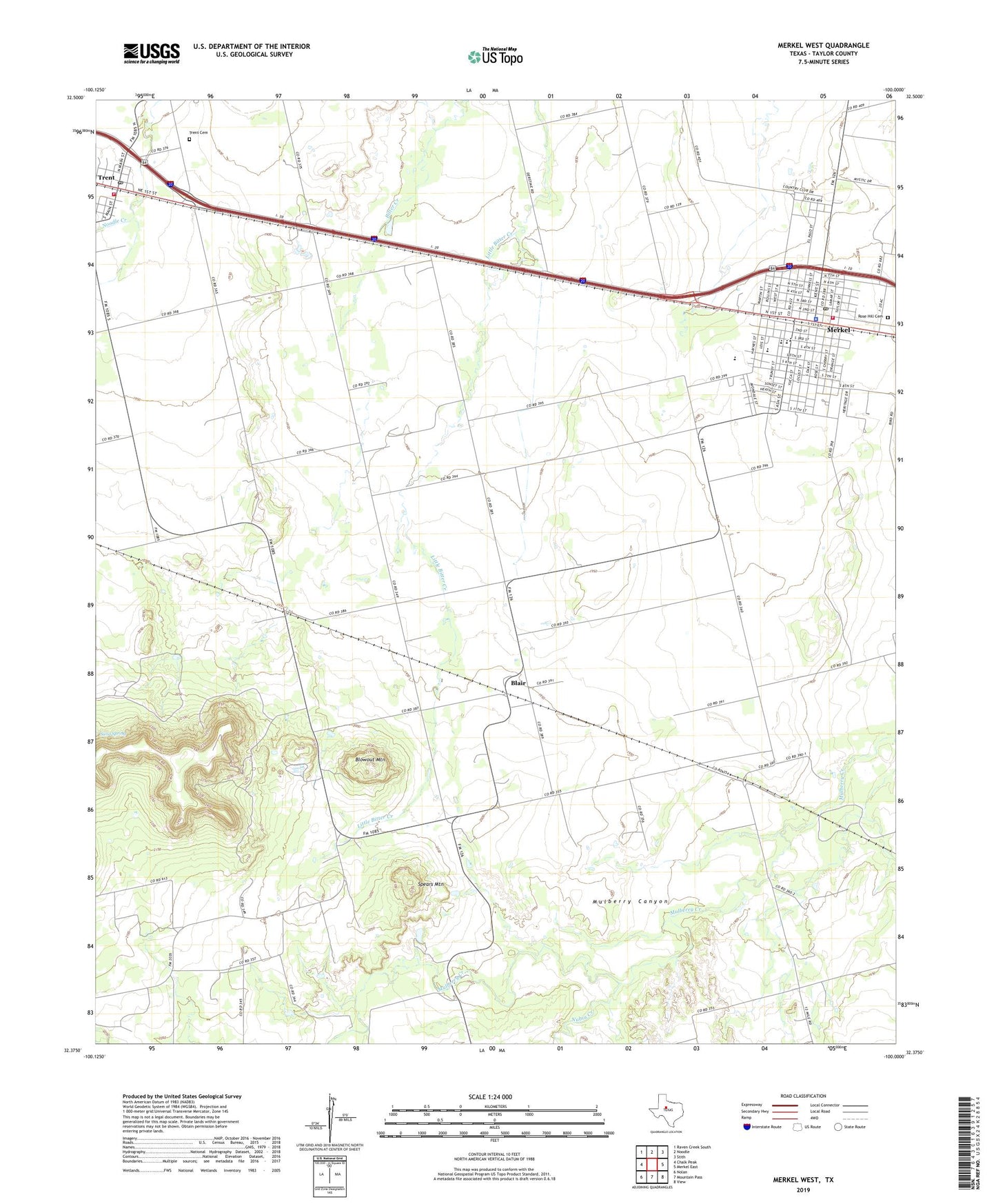
2022 topographic map quadrangle Merkel West in the state of Texas. Scale: 1:24000. Based on the newly updated USGS 7.5' US Topo map series, this map is in the following counties: Taylor. The map contains contour data, water features, and other items you are used to seeing on USGS maps, but also has updated roads and other features. This is the next generation of topographic maps. Printed on high-quality waterproof paper with UV fade-resistant inks.
Quads adjacent to this one:
West: Chalk Peak
Northwest: Raven Creek South
North: Noodle
Northeast: Stith
East: Merkel East
Southeast: View
South: Mountain Pass
Southwest: Nolan
This map covers the same area as the classic USGS quad with code o32100d1.
Contains the following named places: Blair, Blair Oil Field, Blowout Mountain, Church of Christ, First Baptist Church, Gibson Oil Field, KEAN-FM (Abilene), KFQX-FM (Merkel), KMXO-AM (Merkel), KORQ-FM (Abilene), KTLC-FM (Tye), KTXS-TV (Sweetwater), Merkel, Merkel Division, Merkel Elementary School, Merkel Emergency Medical Service, Merkel Intermediate School, Merkel Middle School, Merkel Police Department, Merkel Post Office, Merkel Volunteer Fire Department, Mulberry Canyon, Nubia Creek, Sand Spring, Spears Mountain, Taylor County Constable's Office Precinct 2, Town of Merkel, Town of Trent, Trent Garden of Memories Cemetery, Trent Post Office, Trent Volunteer Fire Department, White Oil Field, ZIP Code: 79536