MyTopo
Newport Texas US Topo Map
Couldn't load pickup availability
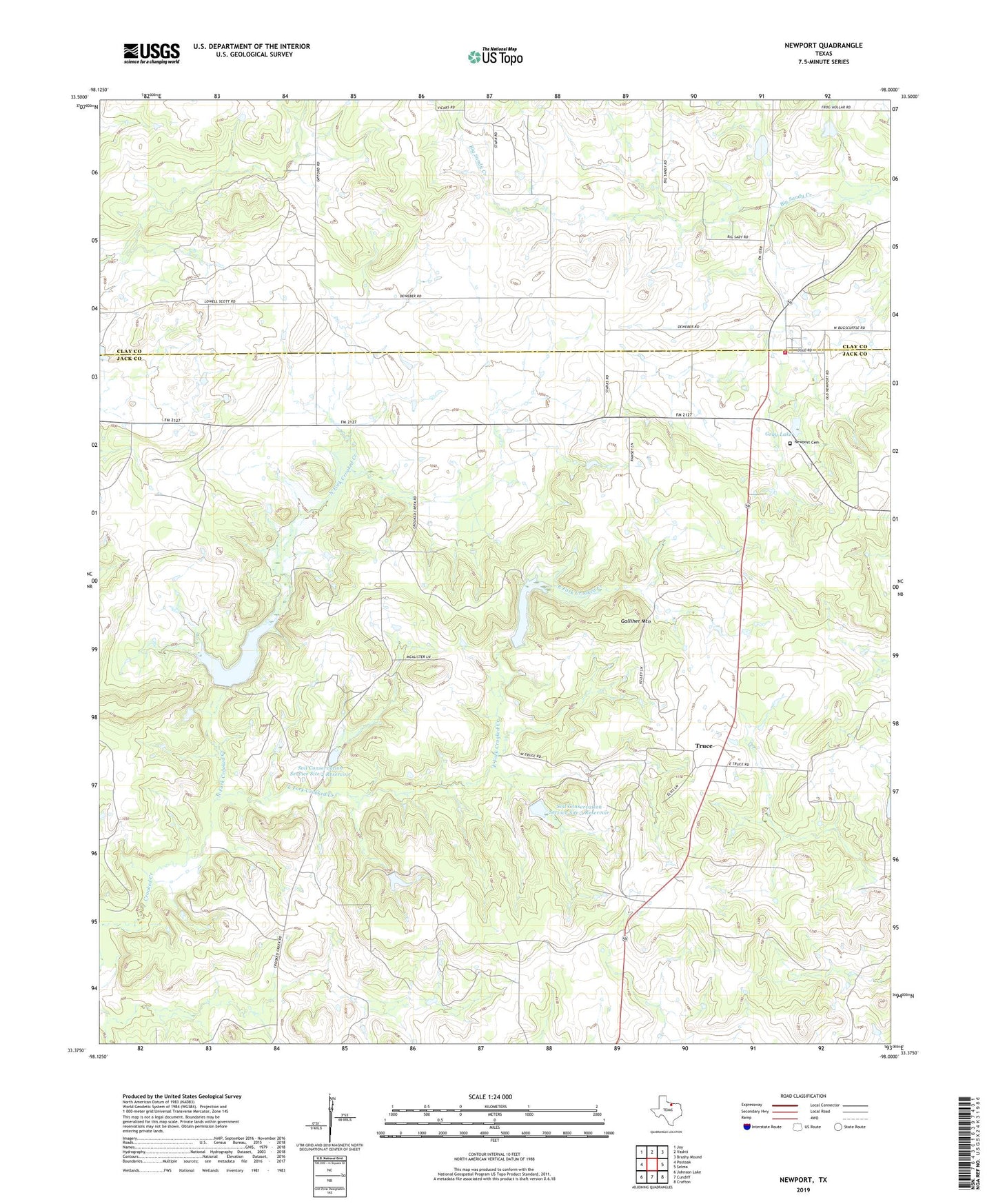
2019 topographic map quadrangle Newport in the state of Texas. Scale: 1:24000. Based on the newly updated USGS 7.5' US Topo map series, this map is in the following counties: Jack, Clay. The map contains contour data, water features, and other items you are used to seeing on USGS maps, but also has updated roads and other features. This is the next generation of topographic maps. Printed on high-quality waterproof paper with UV fade-resistant inks.
Quads adjacent to this one:
West: Postoak
Northwest: Joy
North: Vashti
Northeast: Brushy Mound
East: Selma
Southeast: Crafton
South: Cundiff
Southwest: Johnson Lake
Contains the following named places: East Fork Crooked Creek, Galliher Mountain, Gray Lake, Gray Lake Dam, Newport, Newport Cemetery, Newport Volunteer Fire Department, North Fork Crooked Creek, Soil Conservation Service 1 Dam, Soil Conservation Service 2 Dam, Soil Conservation Service 3 Dam, Soil Conservation Service 3b Dam, Soil Conservation Service Site 1 Reservoir, Soil Conservation Service Site 2 Reservoir, Soil Conservation Service Site 3 Reservoir, Soil Conservation Service Site 3b Reservoir, Truce