MyTopo
Cundiff Texas US Topo Map
Couldn't load pickup availability
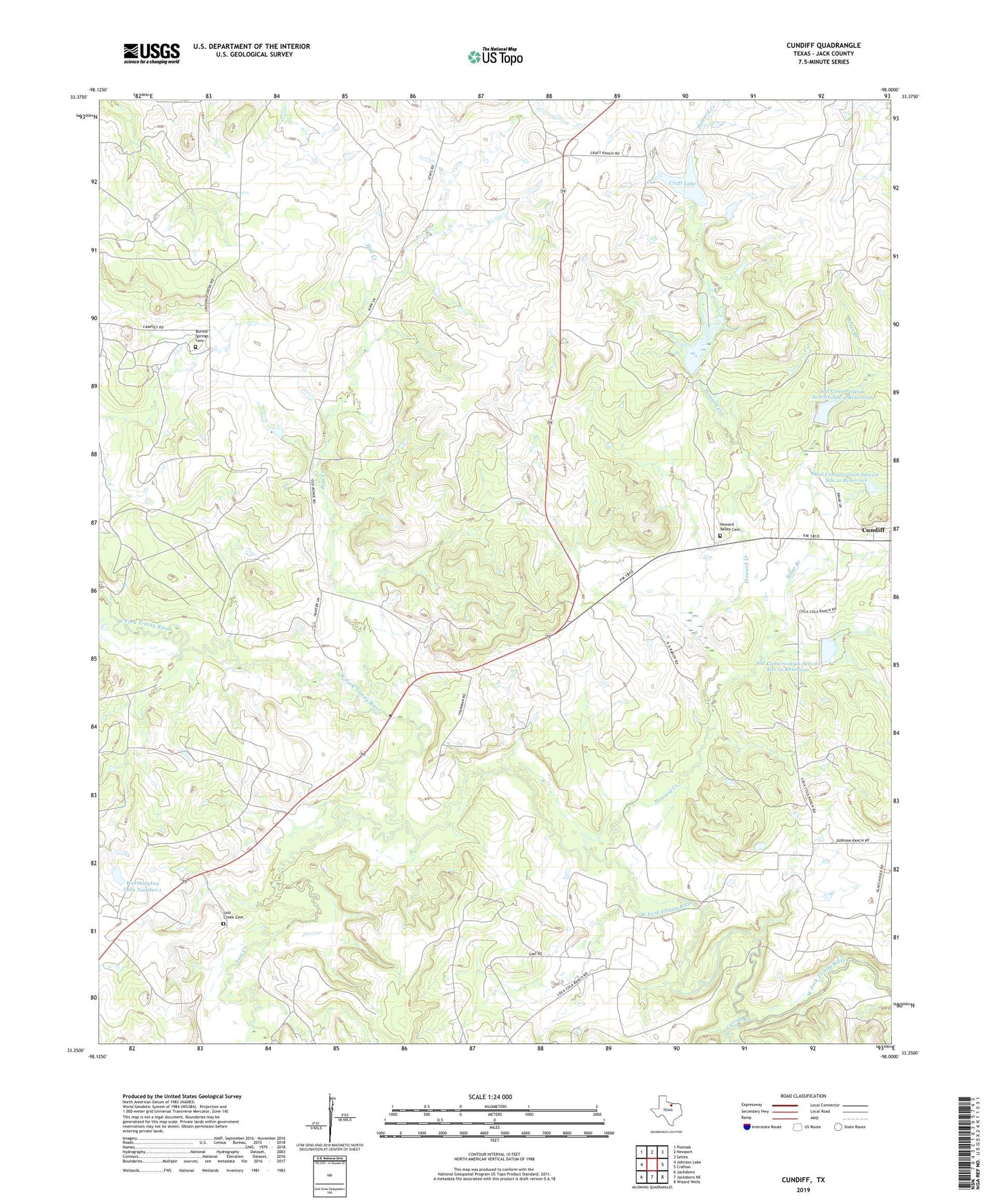
2022 topographic map quadrangle Cundiff in the state of Texas. Scale: 1:24000. Based on the newly updated USGS 7.5' US Topo map series, this map is in the following counties: Jack. The map contains contour data, water features, and other items you are used to seeing on USGS maps, but also has updated roads and other features. This is the next generation of topographic maps. Printed on high-quality waterproof paper with UV fade-resistant inks.
Quads adjacent to this one:
West: Johnson Lake
Northwest: Postoak
North: Newport
Northeast: Selma
East: Crafton
Southeast: Wizard Wells
South: Jacksboro NE
Southwest: Jacksboro
This map covers the same area as the classic USGS quad with code o33098c1.
Contains the following named places: Briar Branch, Burton Springs Cemetery, Carroll Creek, Craft Lake, Craft Lake Dam, Hall Creek, Howard Creek, Howard Valley Cemetery, Lost Creek, Lost Creek Cemetery, Maryetta, Soil Conservation Service 11 Dam, Soil Conservation Service 12 Dam, Soil Conservation Service 6 Dam, Soil Conservation Service 9 Dam, Soil Conservation Service Site 11 Reservoir, Soil Conservation Service Site 12 Reservoir, Soil Conservation Service Site 6 Reservoir, Soil Conservation Service Site 9 Reservoir, Worthington Lake Number 1, Worthington Lake Number 1 Dam