MyTopo
Normangee Texas US Topo Map
Couldn't load pickup availability
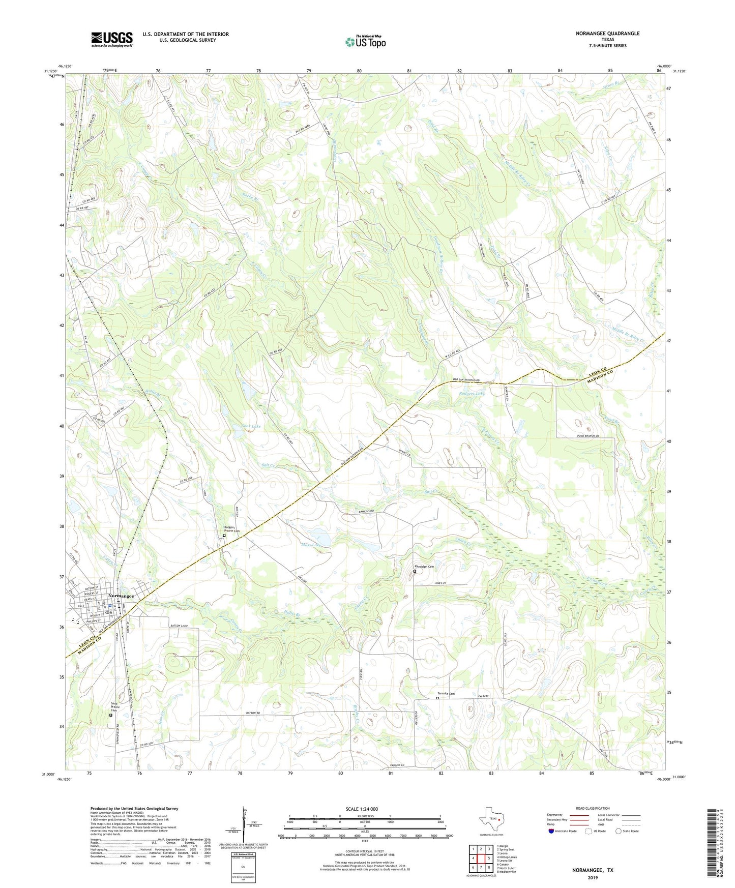
2019 topographic map quadrangle Normangee in the state of Texas. Scale: 1:24000. Based on the newly updated USGS 7.5' US Topo map series, this map is in the following counties: Leon, Madison. The map contains contour data, water features, and other items you are used to seeing on USGS maps, but also has updated roads and other features. This is the next generation of topographic maps. Printed on high-quality waterproof paper with UV fade-resistant inks.
Quads adjacent to this one:
West: Hilltop Lakes
Northwest: Margie
North: Spring Seat
Northeast: Leona
East: Leona SW
Southeast: Madisonville
South: North Zulch
Southwest: Canary
Contains the following named places: Carter School, Cook Lake, Cook Lake Dam, Copeland Branch, Deadman Hollow Branch, East Caney Creek, Galilee Church, Hollis Branch, Jinkins Lake Dam, Middle Branch Church, Moss Lake, Moss Lake Dam, Normangee, Normangee City Hall, Normangee Police Department, Normangee Post Office, Pond Branch, Randolph Cemetery, Rocky Branch, Rodgers Lake, Rodgers Prairie Cemetery, Salt Creek, Sand Prairie Cemetery, Soil Conservation Service Site 1 Dam, Soil Conservation Service Site 1 Reservoir, Tenmile Cemetery, Town of Normangee, Union Church