MyTopo
Hilltop Lakes Texas US Topo Map
Couldn't load pickup availability
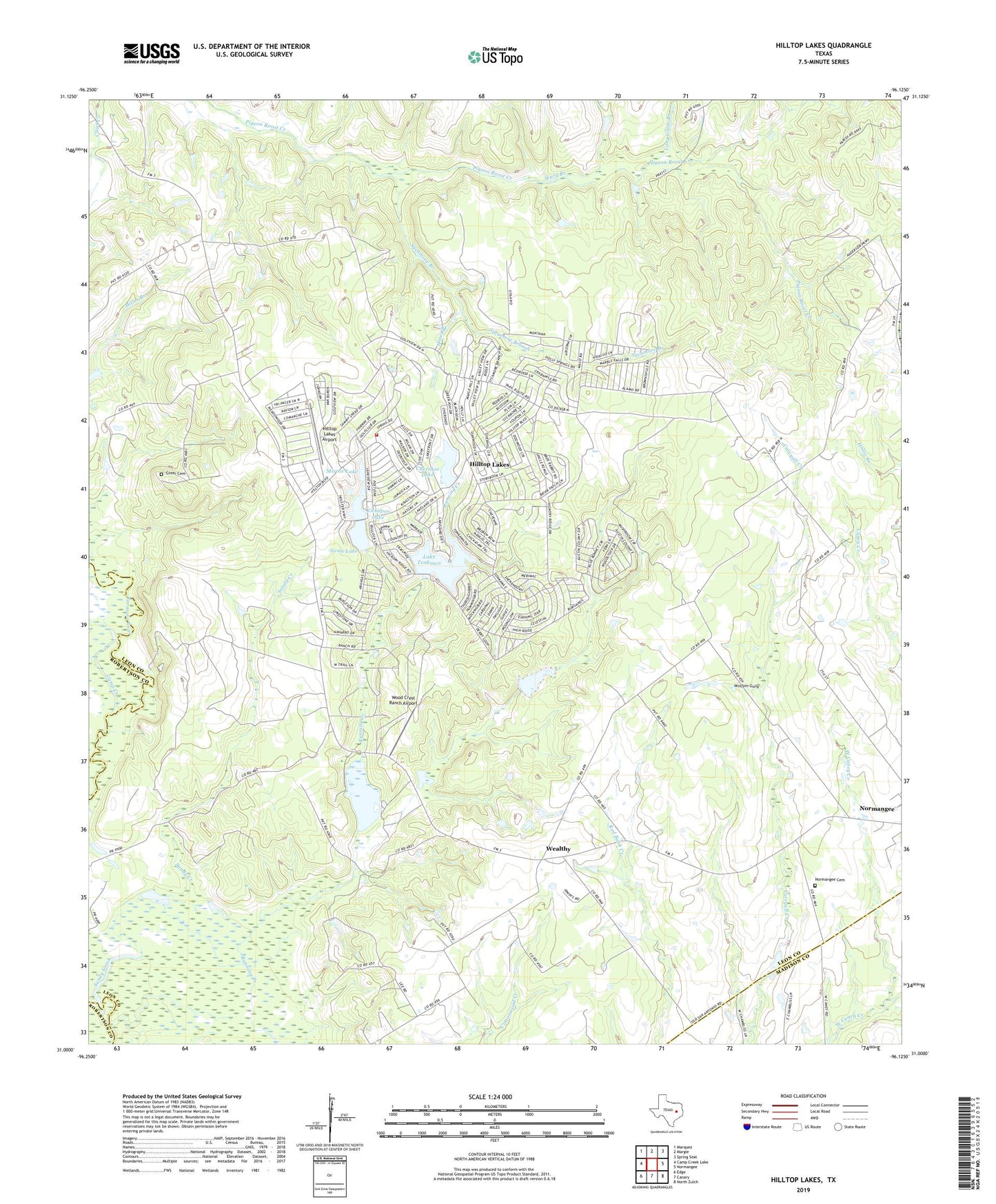
2023 topographic map quadrangle Hilltop Lakes in the state of Texas. Scale: 1:24000. Based on the newly updated USGS 7.5' US Topo map series, this map is in the following counties: Leon, Madison, Robertson. The map contains contour data, water features, and other items you are used to seeing on USGS maps, but also has updated roads and other features. This is the next generation of topographic maps. Printed on high-quality waterproof paper with UV fade-resistant inks.
Quads adjacent to this one:
West: Camp Creek Lake
Northwest: Marquez
North: Margie
Northeast: Spring Seat
East: Normangee
Southeast: North Zulch
South: Canary
Southwest: Edge
This map covers the same area as the classic USGS quad with code o31096a2.
Contains the following named places: Alder Branch, Camp Creek, Cherokee Lake, Cherokee Lake Dam, Cross Roads, Greer Cemetery, Hilltop Downs, Hilltop Lakes, Hilltop Lakes Airport, Hilltop Lakes Census Designated Place, Hilltop Lakes Post Office, Hilltop Lakes Volunteer Fire Department, Hines Branch, Kickapoo Lake, Kickapoo Lake Dam, Lake Tonkawa, Lake Tonkawa Dam, Long Glade Branch, Mirror Lake, Normangee Cemetery, Normangee City Park, Normangee Dam, Normangee Division, Normangee Lake, Sandy Creek, Swan Lake, Swan Lake Dam, Sycamore Branch, Ward Branch, Wealthy, Wolfpin Gully, Wood Crest Ranch Airport, ZIP Code: 77871