MyTopo
Norton Lake Texas US Topo Map
Couldn't load pickup availability
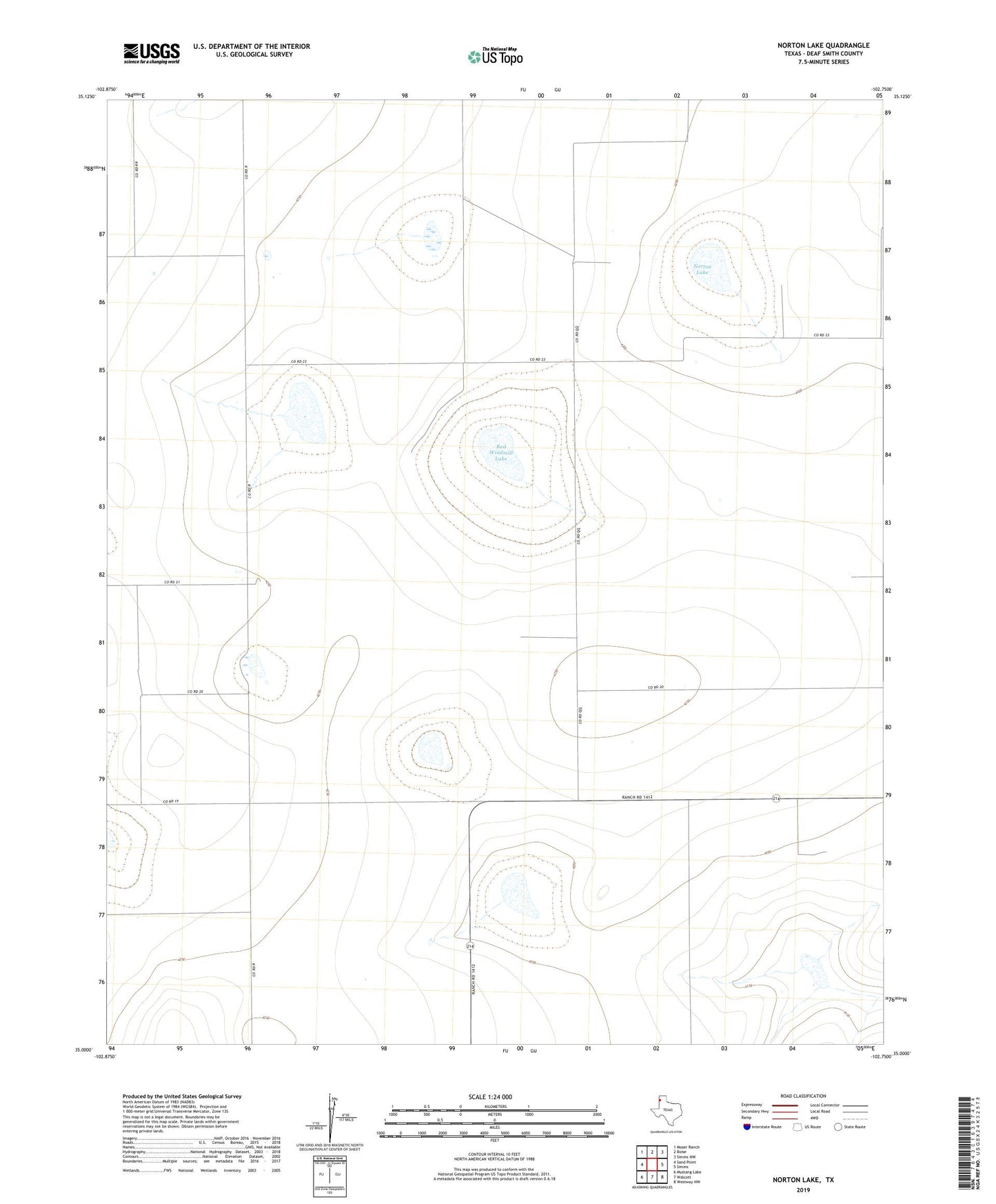
2022 topographic map quadrangle Norton Lake in the state of Texas. Scale: 1:24000. Based on the newly updated USGS 7.5' US Topo map series, this map is in the following counties: Deaf Smith. The map contains contour data, water features, and other items you are used to seeing on USGS maps, but also has updated roads and other features. This is the next generation of topographic maps. Printed on high-quality waterproof paper with UV fade-resistant inks.
Quads adjacent to this one:
West: Sand Point
Northwest: Moser Ranch
North: Boise
Northeast: Simms NW
East: Simms
Southeast: Westway NW
South: Walcott
Southwest: Mustang Lake
This map covers the same area as the classic USGS quad with code o35102a7.
Contains the following named places: Bippus Church, Norton Lake, Perrin Brothers Farm, Red Windmill, Red Windmill Lake