MyTopo
Oplin Texas US Topo Map
Couldn't load pickup availability
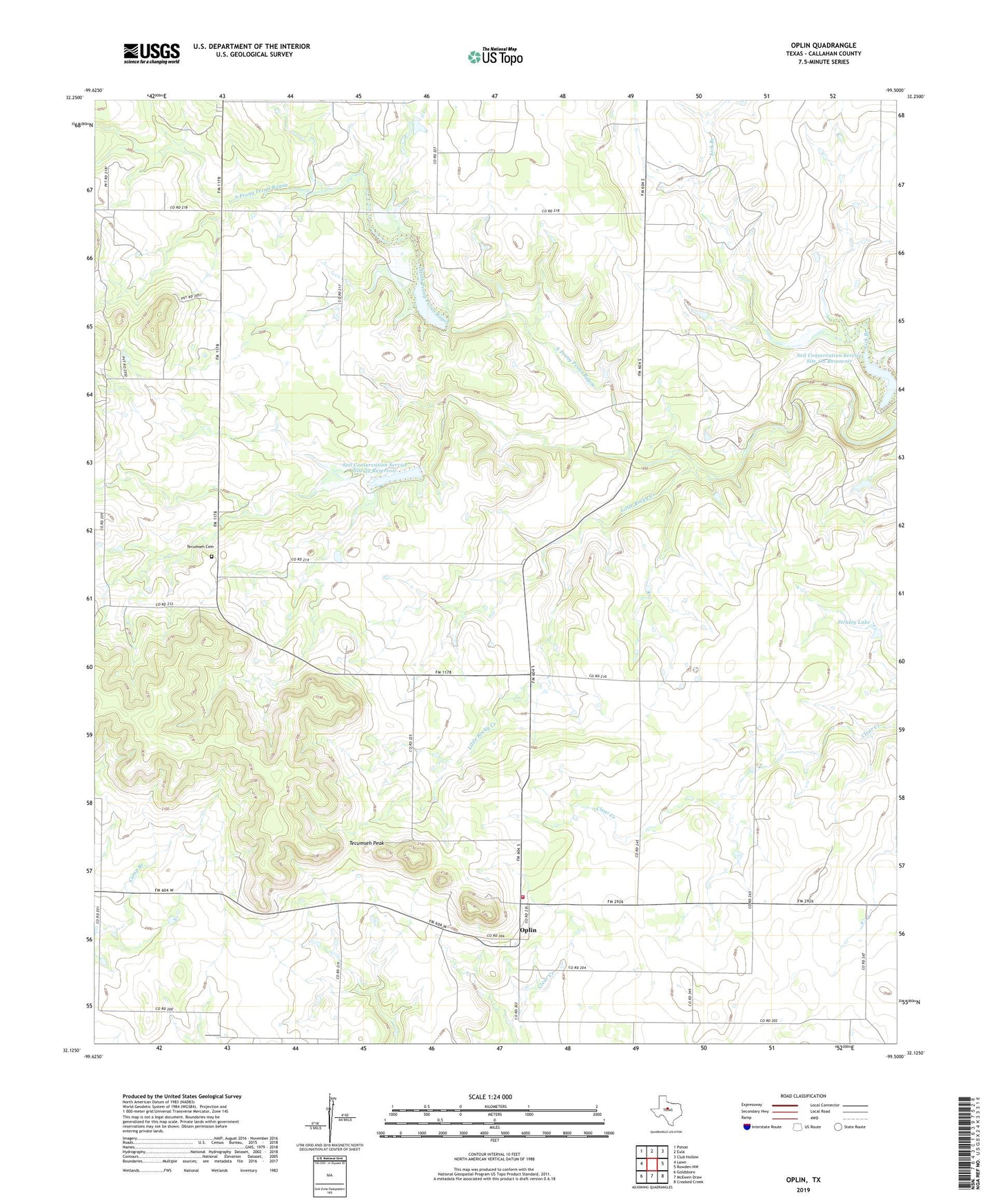
2022 topographic map quadrangle Oplin in the state of Texas. Scale: 1:24000. Based on the newly updated USGS 7.5' US Topo map series, this map is in the following counties: Callahan. The map contains contour data, water features, and other items you are used to seeing on USGS maps, but also has updated roads and other features. This is the next generation of topographic maps. Printed on high-quality waterproof paper with UV fade-resistant inks.
Quads adjacent to this one:
West: Lawn
Northwest: Potosi
North: Eula
Northeast: Club Hollow
East: Rowden NW
Southeast: Crooked Creek
South: McEwen Draw
Southwest: Goldsboro
This map covers the same area as the classic USGS quad with code o32099b5.
Contains the following named places: Dumont Oil Field, Little Rocky Creek, Oplin, Oplin Cemetery, Oplin Volunteer Fire Department, Soil Conservation Service Site 1 Dam, Soil Conservation Service Site 11a Dam, Soil Conservation Service Site 11a Reservoir, Soil Conservation Service Site 2 Dam, Soil Conservation Service Site 2 Reservoir, Soil Conservation Service Site 32 Reservoir, Straley Lake, Straley Lake Dam, Tecumseh Cemetery, Tecumseh Peak