MyTopo
Ottine Texas US Topo Map
Couldn't load pickup availability
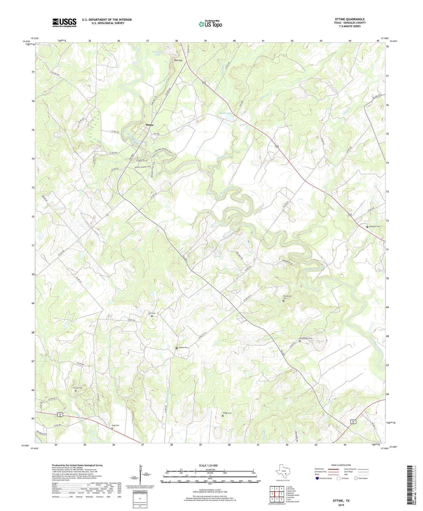
2019 topographic map quadrangle Ottine in the state of Texas. Scale: 1:24000. Based on the newly updated USGS 7.5' US Topo map series, this map is in the following counties: Gonzales. The map contains contour data, water features, and other items you are used to seeing on USGS maps, but also has updated roads and other features. This is the next generation of topographic maps. Printed on high-quality waterproof paper with UV fade-resistant inks.
Quads adjacent to this one:
West: Belmont
Northwest: Luling
North: Harwood
Northeast: Sandy Fork
East: Gonzales North
Southeast: Gonzales South
South: Cost
Southwest: Leesville
Contains the following named places: Artesia Creek, Benke Lake, Benke Lake Dam, Canoe Creek, Clemens Creek, Ellis Cemetery, Foster Cemetery, Glasscock Lake, Glasscock Lake Dam, Gonzales Warm Springs Rehabilitation Foundation, Greenwood Cemetery, Greenwood Church, Harwood-Ottine Division, Hodge Cemetery, Hoods Point Church, King Cemetery, Little Hill Church, McKeller Cemetery, Mule Creek, Ottine, Palmetto State Park, Palmetto State Park - Lake Trail, Palmetto State Park - Nature and Hiking Trail, Palmetto State Park - Palmetto Trail, Palmetto State Park - River Trail, Princeville Cemetery, Princeville Church, Randle Cemetery, Red Hill, Saint James, Saint Luke Church, Slayden, Smithville, Texas Elks Hospital, Zedler Dam, Zedler Lake