MyTopo
Cost Texas US Topo Map
Couldn't load pickup availability
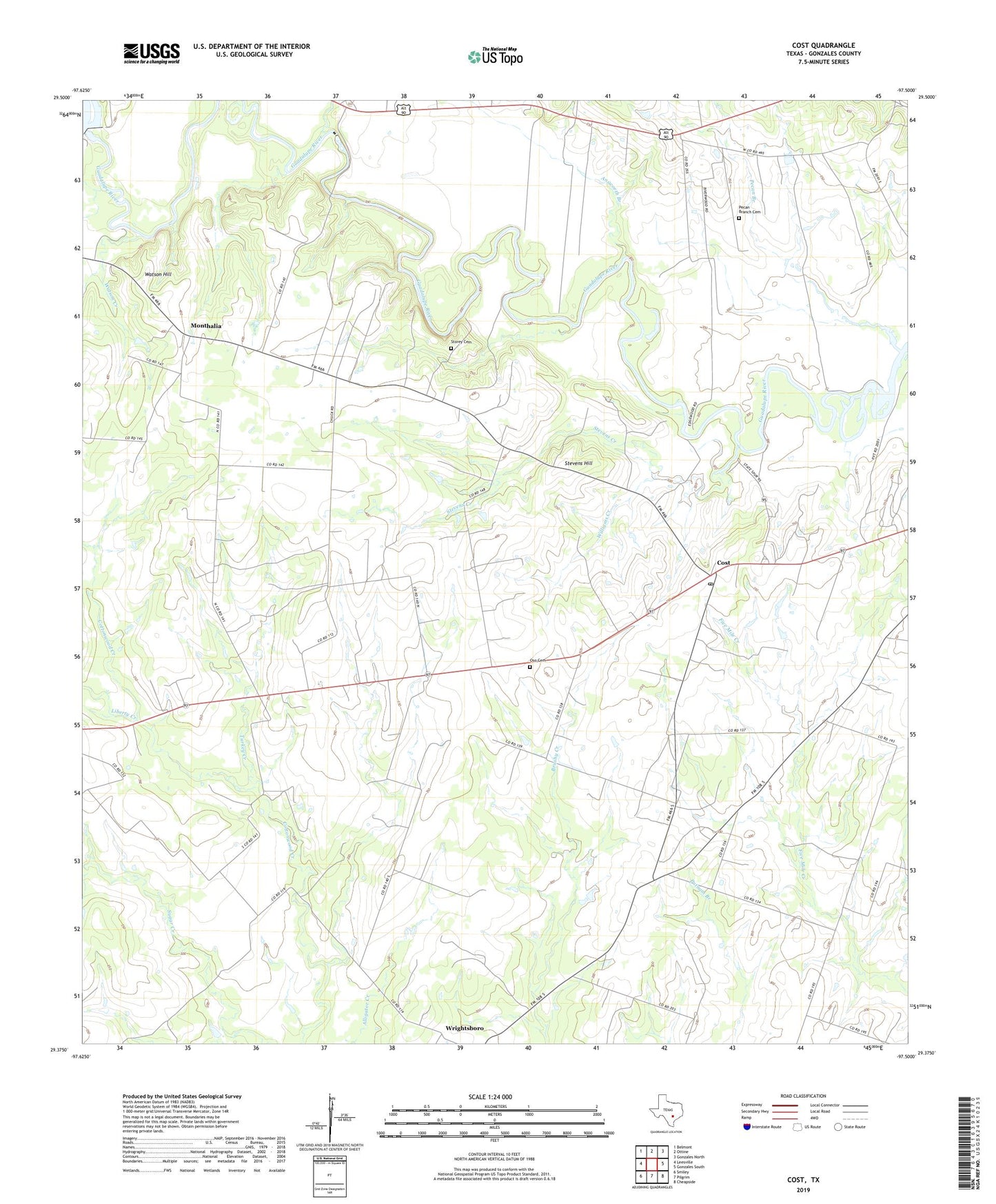
2022 topographic map quadrangle Cost in the state of Texas. Scale: 1:24000. Based on the newly updated USGS 7.5' US Topo map series, this map is in the following counties: Gonzales. The map contains contour data, water features, and other items you are used to seeing on USGS maps, but also has updated roads and other features. This is the next generation of topographic maps. Printed on high-quality waterproof paper with UV fade-resistant inks.
Quads adjacent to this one:
West: Leesville
Northwest: Belmont
North: Ottine
Northeast: Gonzales North
East: Gonzales South
Southeast: Cheapside
South: Pilgrim
Southwest: Smiley
This map covers the same area as the classic USGS quad with code o29097d5.
Contains the following named places: Answorth Branch, Cost, Cost Post Office, Cost School, Floyd Chapel, Keifer Slough, Lake Gonzales Dam, Liberty Creek, M A Wade Dam, M A Wade Lake, Monthalia, Monthalia Church, Oak Forest, Oso Cemetery, Pecan Branch, Pecan Branch Cemetery, Stevens Creek, Stevens Hill, Storey Cemetery, Texas A and M College Experimental Station, Turkey Creek, Watson Creek, Watson Hill, Williams Creek, ZIP Code: 78614