MyTopo
Palito Blanco Texas US Topo Map
Couldn't load pickup availability
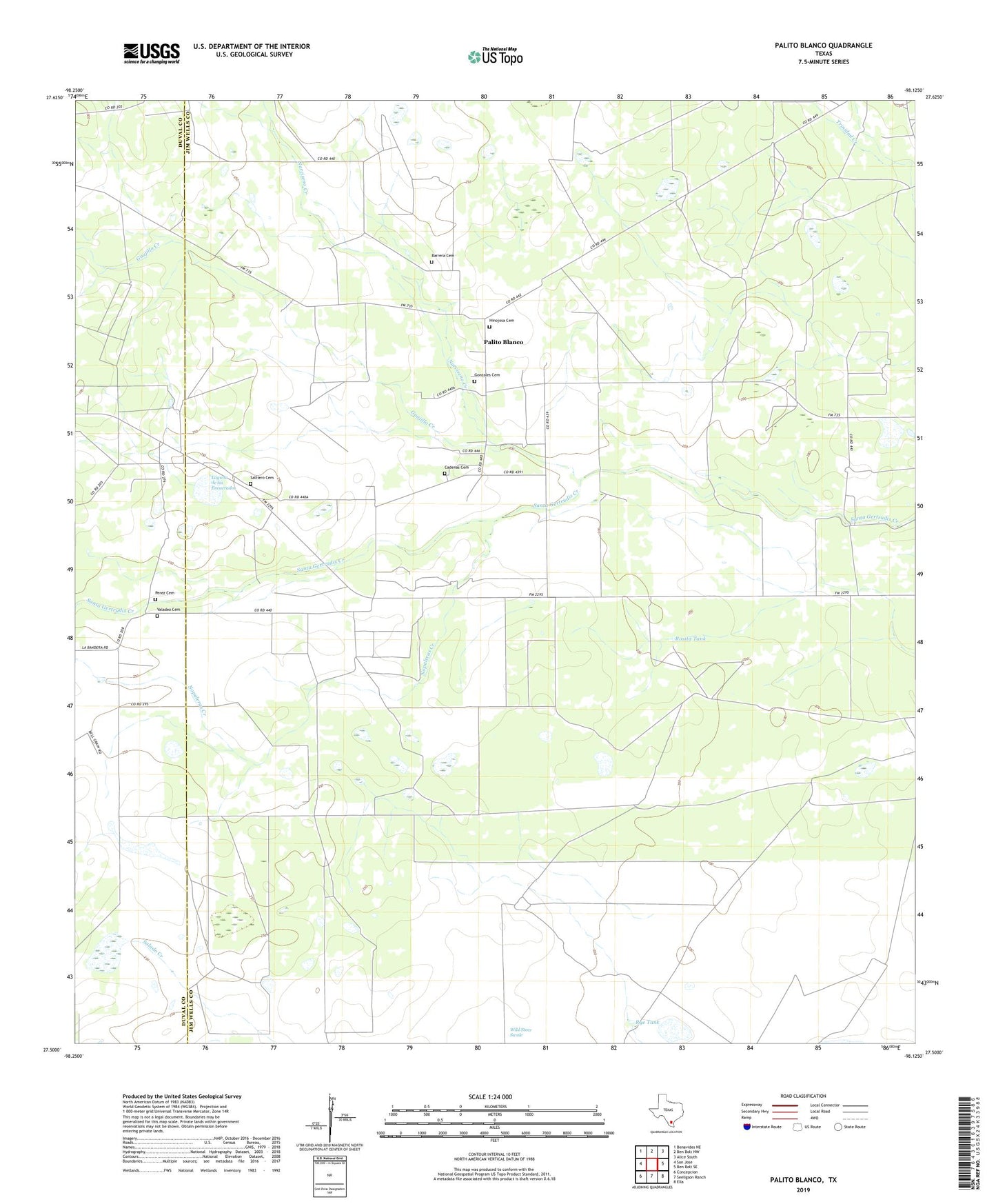
2019 topographic map quadrangle Palito Blanco in the state of Texas. Scale: 1:24000. Based on the newly updated USGS 7.5' US Topo map series, this map is in the following counties: Jim Wells, Duval. The map contains contour data, water features, and other items you are used to seeing on USGS maps, but also has updated roads and other features. This is the next generation of topographic maps. Printed on high-quality waterproof paper with UV fade-resistant inks.
Quads adjacent to this one:
West: San Jose
Northwest: Benavides NE
North: Ben Bolt NW
Northeast: Alice South
East: Ben Bolt SE
Southeast: Ella
South: Seeligson Ranch
Southwest: Concepcion
Contains the following named places: Barrera Cemetery, Cadenas Cemetery, Gonzales Cemetery, Guajillo Creek, Hinojosa Cemetery, Javalina Windmill, La Bandera Ranch, La Coma Windmill, Laguna de los Encuerados, Lucero Windmill, Moos Ranch, Narciseno Creek, Nopaleras Creek, Palito Blanco, Perez Cemetery, Pila Blanca Windmill, Rosita Tank, Rosita Windmill, Rye Tank, Saltiero Cemetery, Saltiero Ranch, San Jose Church, Valadez Cemetery