MyTopo
Benavides NE Texas US Topo Map
Couldn't load pickup availability
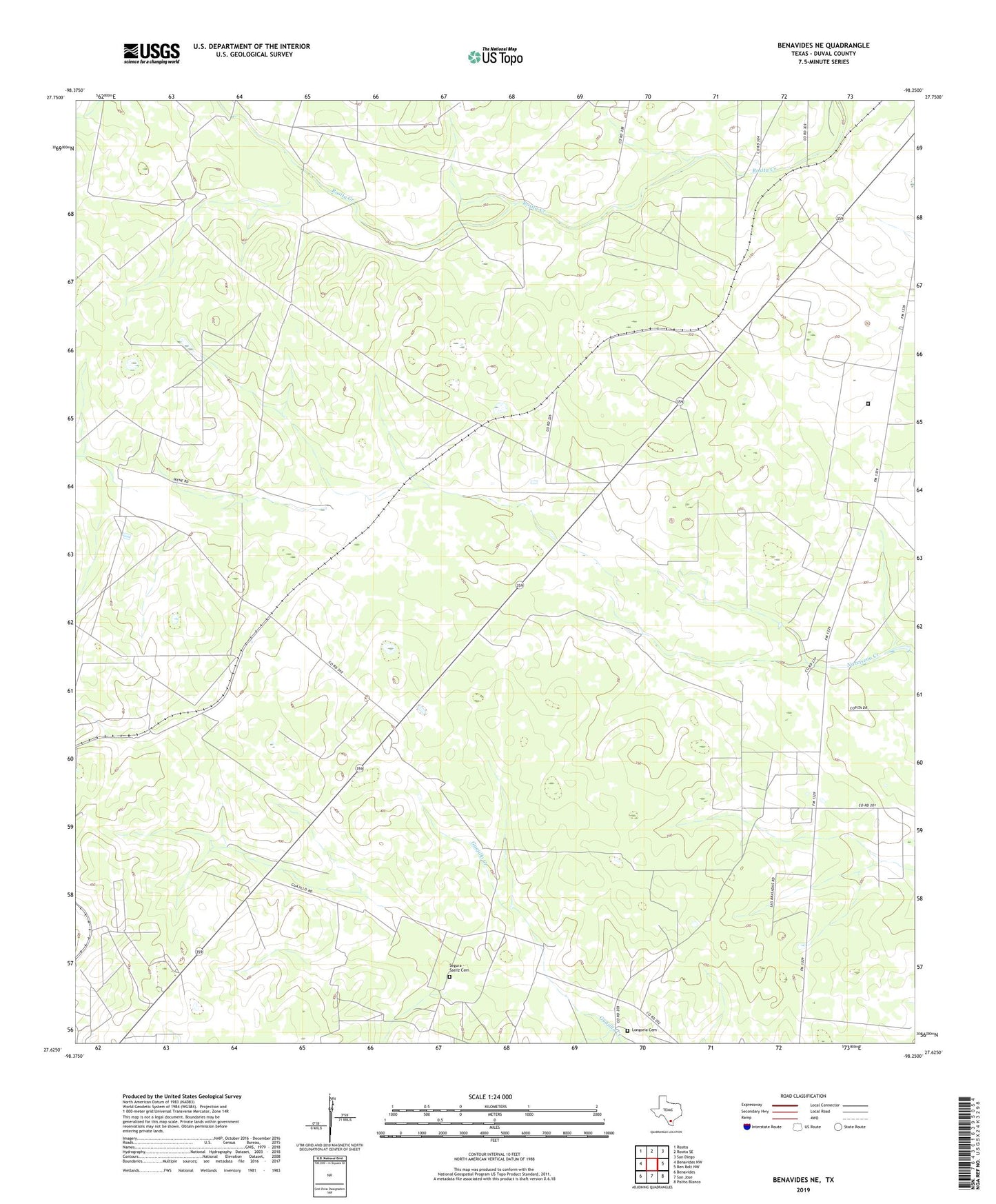
2022 topographic map quadrangle Benavides NE in the state of Texas. Scale: 1:24000. Based on the newly updated USGS 7.5' US Topo map series, this map is in the following counties: Duval. The map contains contour data, water features, and other items you are used to seeing on USGS maps, but also has updated roads and other features. This is the next generation of topographic maps. Printed on high-quality waterproof paper with UV fade-resistant inks.
Quads adjacent to this one:
West: Benavides NW
Northwest: Rosita
North: Rosita SE
Northeast: San Diego
East: Ben Bolt NW
Southeast: Palito Blanco
South: San Jose
Southwest: Benavides
This map covers the same area as the classic USGS quad with code o27098f3.
Contains the following named places: Blanco Well, Canogita Well, Chueco Well, Clemente Well, Colorado Well Number One, Colorado Well Number Three, Colorado Well Number Two, Guajillo Well, Llano Well, Longoria Cemetery, Martin Well, Porvenil Well, Pozo Well, Segura - Saenz Cemetery, Texas Department of Criminal Justice Ernestine Glossbrenner Unit