MyTopo
Pat Mayse Lake East Texas US Topo Map
Couldn't load pickup availability
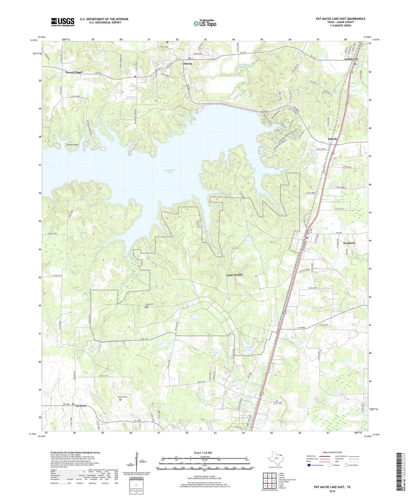
2019 topographic map quadrangle Pat Mayse Lake East in the state of Texas. Scale: 1:24000. Based on the newly updated USGS 7.5' US Topo map series, this map is in the following counties: Lamar. The map contains contour data, water features, and other items you are used to seeing on USGS maps, but also has updated roads and other features. This is the next generation of topographic maps. Printed on high-quality waterproof paper with UV fade-resistant inks.
Quads adjacent to this one:
West: Pat Mayse Lake West
Northwest: Bluff
North: Grant
Northeast: Shoals
East: Slate Shoals
Southeast: Blossom
South: Paris
Southwest: Toco
Contains the following named places: Arthur City, Arthur City Post Office, Assembly of God Church, Camp Maxey, Casey Cemetery, Caviness, Chicota, Chicota Post Office, Chicota Volunteer Fire Department, Church of God, Forest Chapel, Forest Chapel Church, Forest Point, Lamar Lake, Lamar Lake Dam, Lamar Point Volunteer Fire Department Station 2, Littlejohn Cemetery, McEwin Cemetery, Midcity, Mount Tabor Cemetery, Mount Tabor Church, Pat Mayse Dam, Pat Mayse Lake, Pat Mayse Reservoir, Pat Mayse State Wildlife Management Area, Powderly, Powderly Airport, Powderly Census Designated Place, Powderly Division, Powderly Post Office, Powderly Volunteer Fire Department, Presbyterian Church, Sanders Cove, Soil Conservation Service Site 10 Dam, Soil Conservation Service Site 10 Reservoir