MyTopo
Grant Oklahoma US Topo Map
Couldn't load pickup availability
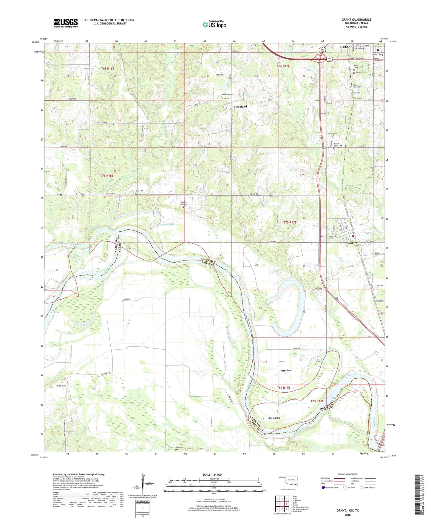
2022 topographic map quadrangle Grant in the states of Oklahoma, Texas. Scale: 1:24000. Based on the newly updated USGS 7.5' US Topo map series, this map is in the following counties: Choctaw, Lamar. The map contains contour data, water features, and other items you are used to seeing on USGS maps, but also has updated roads and other features. This is the next generation of topographic maps. Printed on high-quality waterproof paper with UV fade-resistant inks.
Quads adjacent to this one:
West: Bluff
Northwest: Soper
North: Hugo
Northeast: Hugo Dam
East: Shoals
Southeast: Slate Shoals
South: Pat Mayse Lake East
Southwest: Pat Mayse Lake West
Contains the following named places: Allen Island, Antioch Church, Boggy Cutoff, Cold Springs Church, Crosley Cemetery, Gay, Gay Cemetery, Gay School, Goodland, Goodland Academy, Goodland Cemetery, Goodland Elementary School, Grant, Grant Census Designated Place, Grant Elementary School, Grant Post Office, Grant Volunteer Fire Department, Grassy Lake, Hanubby Creek, Heathcock Branch, Horse Prairie Church, Hugo Elementary School, Mount Olive Cemetery, Mount Olive Church, Mount Olivet Cemetery, Mount Pleasant Church, Muddy Boggy Creek, Pitts Bend, Roebuck Lake, Sanders Creek, Southside Baptist Church, Springs Cemetery, Springs Chapel, Springs Chapel Cemetery, Springs Family Cemetery, Sweet Hill Cemetery