MyTopo
Pat Mayse Lake West Texas US Topo Map
Couldn't load pickup availability
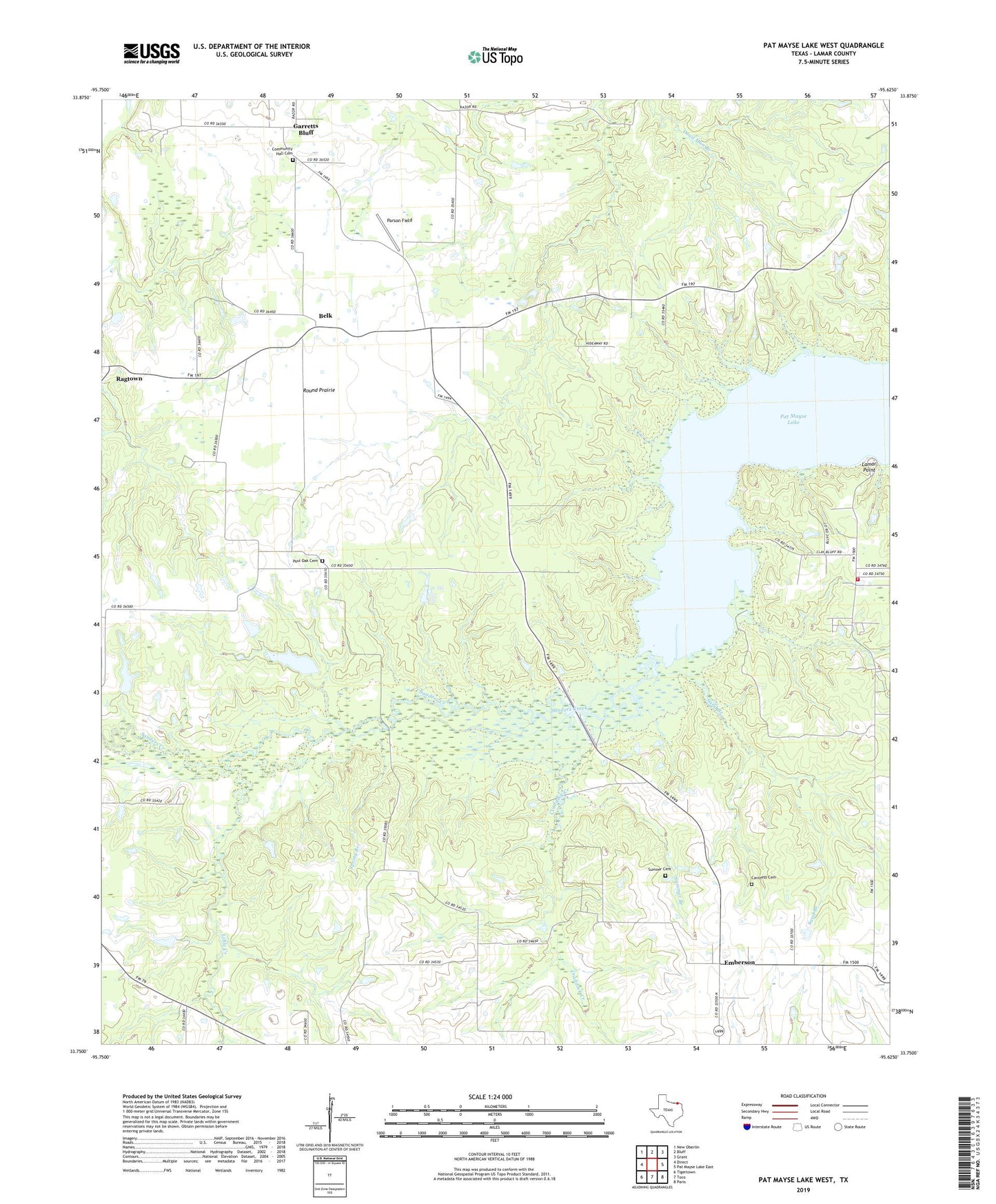
2022 topographic map quadrangle Pat Mayse Lake West in the state of Texas. Scale: 1:24000. Based on the newly updated USGS 7.5' US Topo map series, this map is in the following counties: Lamar. The map contains contour data, water features, and other items you are used to seeing on USGS maps, but also has updated roads and other features. This is the next generation of topographic maps. Printed on high-quality waterproof paper with UV fade-resistant inks.
Quads adjacent to this one:
West: Direct
Northwest: New Oberlin
North: Bluff
Northeast: Grant
East: Pat Mayse Lake East
Southeast: Paris
South: Toco
Southwest: Tigertown
This map covers the same area as the classic USGS quad with code o33095g6.
Contains the following named places: Belk, Bibleway Church, Campbell Lake, Campbell Lake Dam, Caviness Cemetery, Community Hall Cemetery, Craddock Creek, Craddock School, Davis School, Emberson, Garretts Bluff, Lamar Point, Lamar Point Volunteer Fire Department Station 1, Little Creek, Parson Field, Pat Mayse State Park 1, Pat Mayse State Park 2, Post Oak Cemetery, Post Oak School, Ragtown, Round Prairie, Sand Branch, Spring Branch, Summer Branch, Sumner Cemetery, Sumner Division, United Methodist Church, Willow Lake, Willow Lake Dam, ZIP Code: 75411