MyTopo
Toco Texas US Topo Map
Couldn't load pickup availability
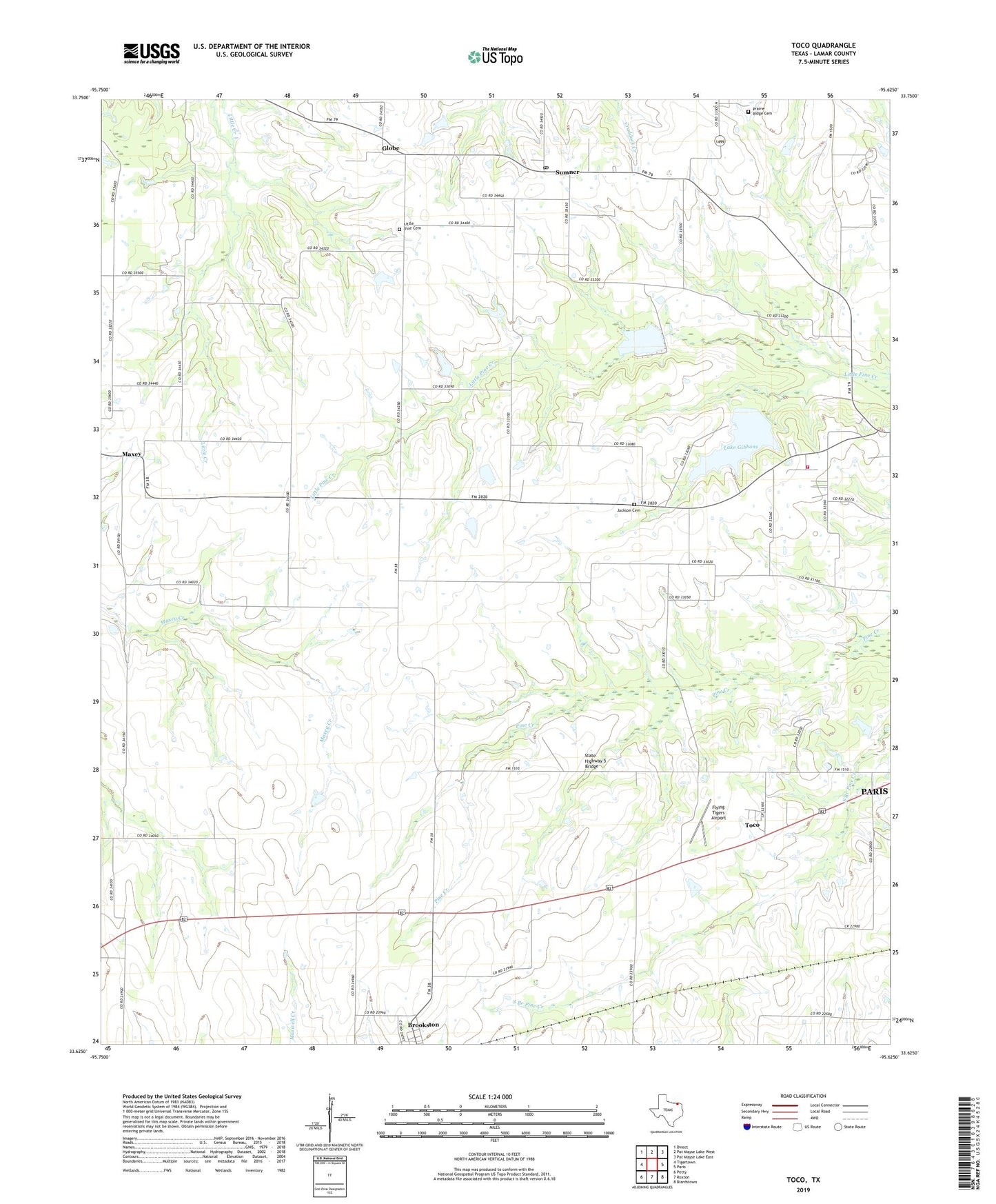
2022 topographic map quadrangle Toco in the state of Texas. Scale: 1:24000. Based on the newly updated USGS 7.5' US Topo map series, this map is in the following counties: Lamar. The map contains contour data, water features, and other items you are used to seeing on USGS maps, but also has updated roads and other features. This is the next generation of topographic maps. Printed on high-quality waterproof paper with UV fade-resistant inks.
Quads adjacent to this one:
West: Tigertown
Northwest: Direct
North: Pat Mayse Lake West
Northeast: Pat Mayse Lake East
East: Paris
Southeast: Biardstown
South: Roxton
Southwest: Petty
This map covers the same area as the classic USGS quad with code o33095f6.
Contains the following named places: Ballinger School, City of Toco, El Bethel Church, Flying Tigers Airport, Gambill Wildlife Refuge, Globe, Hopewell, Hopewell Church, Hopewell Volunteer Fire Department, Jackson Cemetery, Lake Gibbons, Lake Gibbons Dam, Little Vine Cemetery, Little Vine Church, Mount Maxey Community Club, Mount Vernon Church, Pleasant Hill School, Prairie Ridge Cemetery, Shiloh School, Soil Conservation Service Site 3 Dam, Soil Conservation Service Site 3 Reservoir, State Highway 5 Bridge, Sumner, Sumner Post Office, Toco, Toco City Hall, ZIP Codes: 75421, 75486