MyTopo
Patroon South Texas US Topo Map
Couldn't load pickup availability
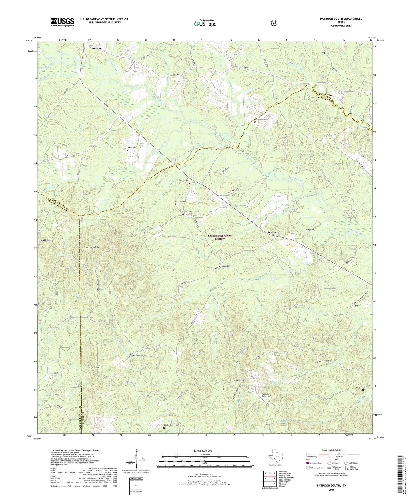
2019 topographic map quadrangle Patroon South in the state of Texas. Scale: 1:24000. Based on the newly updated USGS 7.5' US Topo map series, this map is in the following counties: Sabine, Shelby, San Augustine. The map contains contour data, water features, and other items you are used to seeing on USGS maps, but also has updated roads and other features. This is the next generation of topographic maps. Printed on high-quality waterproof paper with UV fade-resistant inks.
Quads adjacent to this one:
West: San Augustine East
Northwest: Hurstown
North: Patroon North
Northeast: Brushy Creek
East: East Hamilton
Southeast: Milam
South: Geneva
Southwest: Chinquapin
Contains the following named places: Alexanders Store, Allen Creek, Apostolic Cemetery, Apostolic Church, Bell Cemetery, Bell Chapel, Bickley Cemetery, Black Ankle Church, Browns Chapel, Buckley Creek, Bull Bay Creek, Carrent Church, Clear Creek, Colorow Creek, Cordrey Cemetery, Corinth Cemetery, Crockett Cemetery, Dunnigan Church, Forse Mountain, Horton Creek, Indian Creek, Ingram Cemetery, Ingram Church, Lick Creek, Matlock Hills, Munnerlyn Cemetery, Mushotuba Creek, New Jerusalem Church, Patroon, Polley Cemetery, Prairie Creek, Reeves Cemetery, Sandy Creek, Sexton, Sweet Cemetery, Williams Family Cemetery, Windham Cemetery