MyTopo
Pearl Texas US Topo Map
Couldn't load pickup availability
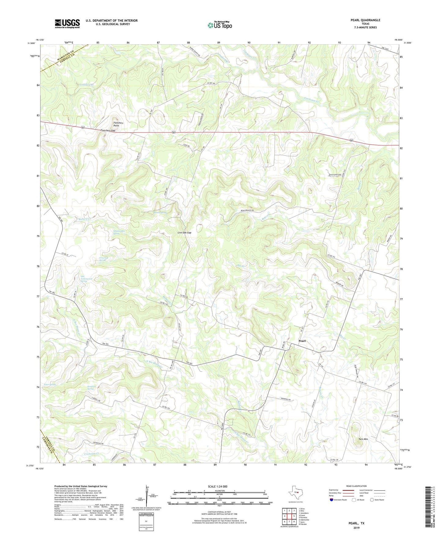
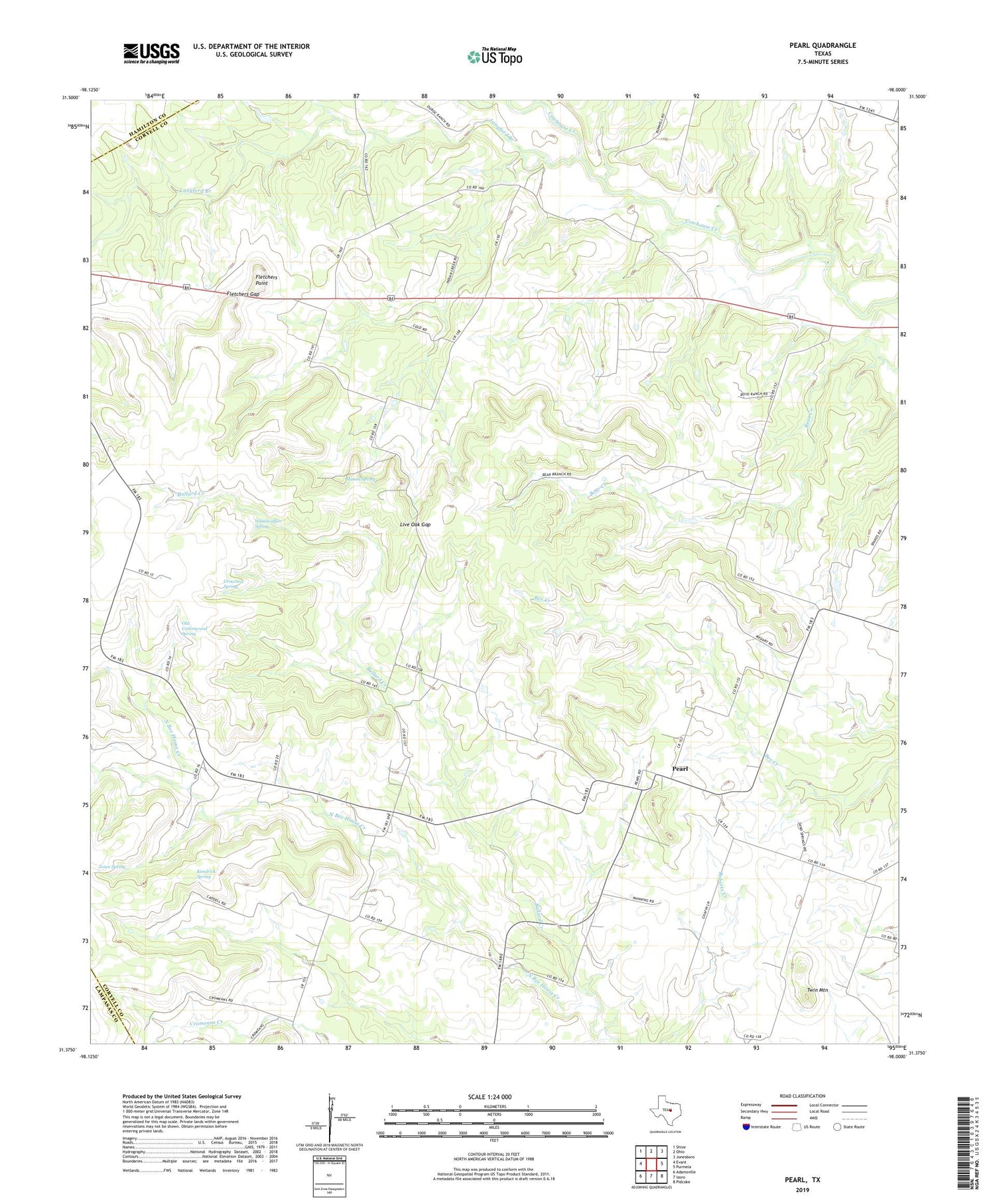
2019 topographic map quadrangle Pearl in the state of Texas. Scale: 1:24000. Based on the newly updated USGS 7.5' US Topo map series, this map is in the following counties: Coryell, Hamilton, Lampasas. The map contains contour data, water features, and other items you are used to seeing on USGS maps, but also has updated roads and other features. This is the next generation of topographic maps. Printed on high-quality waterproof paper with UV fade-resistant inks.
Quads adjacent to this one:
West: Evant
Northwest: Shive
North: Ohio
Northeast: Jonesboro
East: Purmela
Southeast: Pidcoke
South: Izoro
Southwest: Adamsville
Contains the following named places: Bear Creek, Bee House, Bullard Creek, Cromeans Creek, Crownest Spring, Fletchers Gap, Fletchers Point, Jones Spring, Kendrick Spring, Langford Branch, Live Oak Gap, Manos Spring, Old Cottonwood Spring, Pearl, Twin Mountain, Whitewalker Spring