MyTopo
Penwell SE Texas US Topo Map
Couldn't load pickup availability
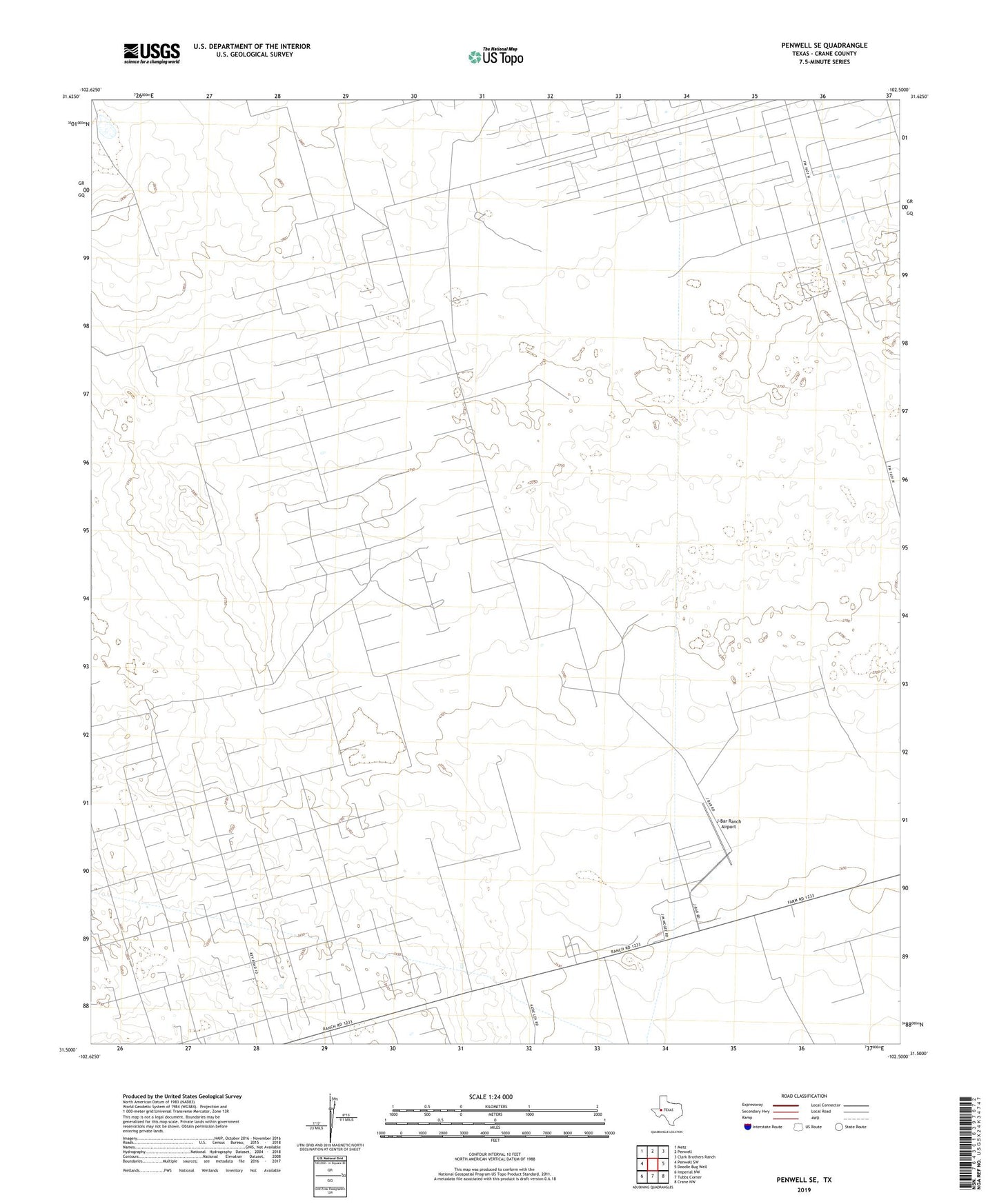
2022 topographic map quadrangle Penwell SE in the state of Texas. Scale: 1:24000. Based on the newly updated USGS 7.5' US Topo map series, this map is in the following counties: Crane. The map contains contour data, water features, and other items you are used to seeing on USGS maps, but also has updated roads and other features. This is the next generation of topographic maps. Printed on high-quality waterproof paper with UV fade-resistant inks.
Quads adjacent to this one:
West: Penwell SW
Northwest: Metz
North: Penwell
Northeast: Clark Brothers Ranch
East: Doodle Bug Well
Southeast: Crane NW
South: Tubbs Corner
Southwest: Imperial NW
This map covers the same area as the classic USGS quad with code o31102e5.
Contains the following named places: C Bar Oil Field, Corner Well, Crane North Division, Cummins Well, East Well, J Bar Ranch, J-Bar Ranch Airport, Kyle Well, Little Star Well, Middle Henderson Well, North Henderson Well, Russell Well, Sand Well, Schinery Well, South Henderson Well, West Well