MyTopo
Perryton Texas US Topo Map
Couldn't load pickup availability
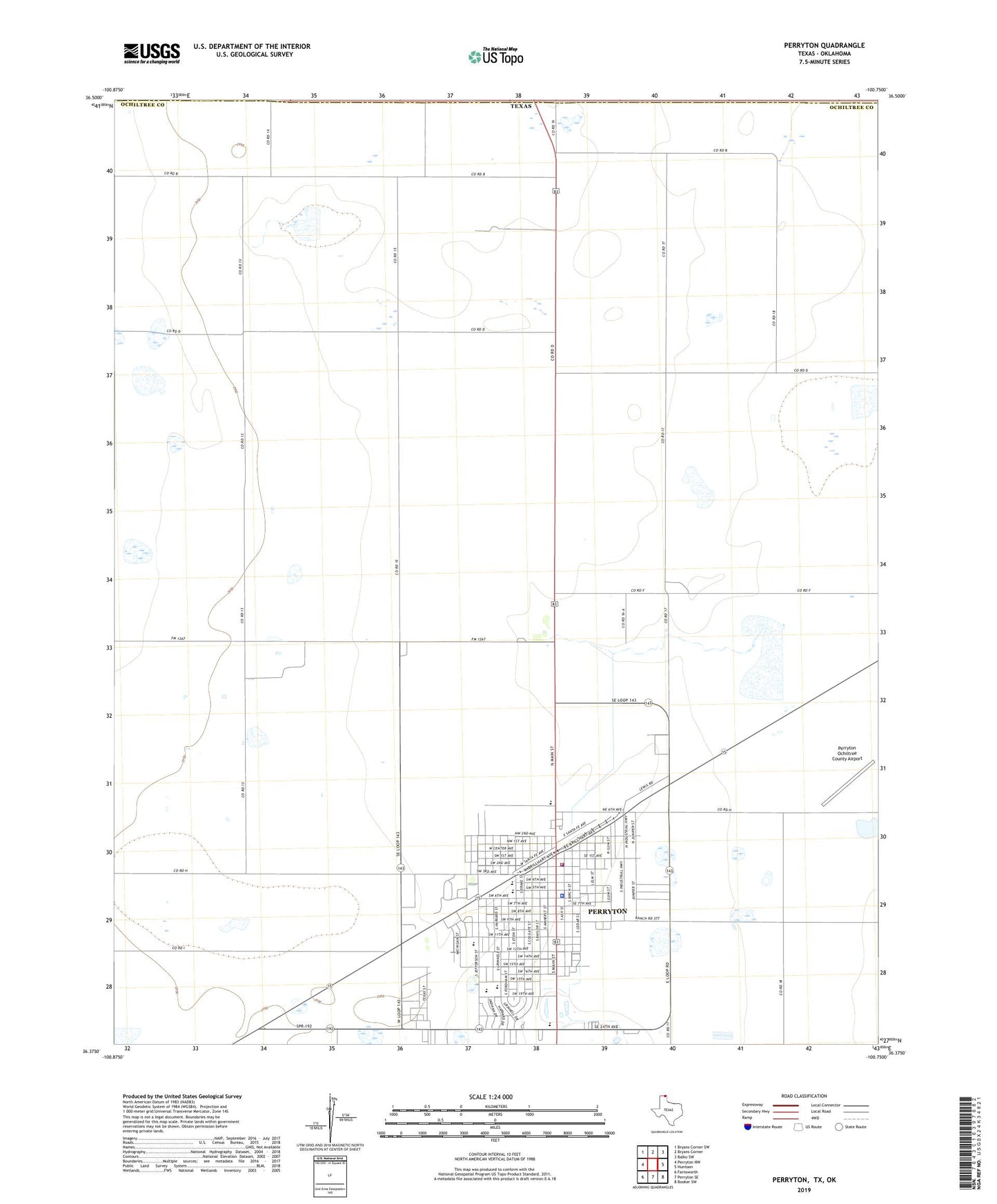
2022 topographic map quadrangle Perryton in the state of Texas. Scale: 1:24000. Based on the newly updated USGS 7.5' US Topo map series, this map is in the following counties: Ochiltree, Beaver. The map contains contour data, water features, and other items you are used to seeing on USGS maps, but also has updated roads and other features. This is the next generation of topographic maps. Printed on high-quality waterproof paper with UV fade-resistant inks.
Quads adjacent to this one:
West: Perryton NW
Northwest: Bryans Corner SW
North: Bryans Corner
Northeast: Balko SW
East: Huntoon
Southeast: Booker SW
South: Perryton SE
Southwest: Farnsworth
This map covers the same area as the classic USGS quad with code o36100d7.
Contains the following named places: Central Junior High School, Church of Christ, Church of the Nazarene, City of Perryton, First Baptist Church, Key Heights Baptist Church, KEYE-AM (Perryton), Leatherman Park, Museum of the Plains, Ochiltree County Constable's Office, Ochiltree County Courthouse, Ochiltree County Sheriffs Office, Perryton, Perryton City Hall, Perryton Fire and Emergency Medical Services, Perryton High School, Perryton Junior High School, Perryton Kinder School, Perryton Police Department, Plainview Hardware Company Building, Southside Baptist Church, Stark Park, United Pentecostal Church, Wright Elementary School