MyTopo
Pertle Creek Texas US Topo Map
Couldn't load pickup availability
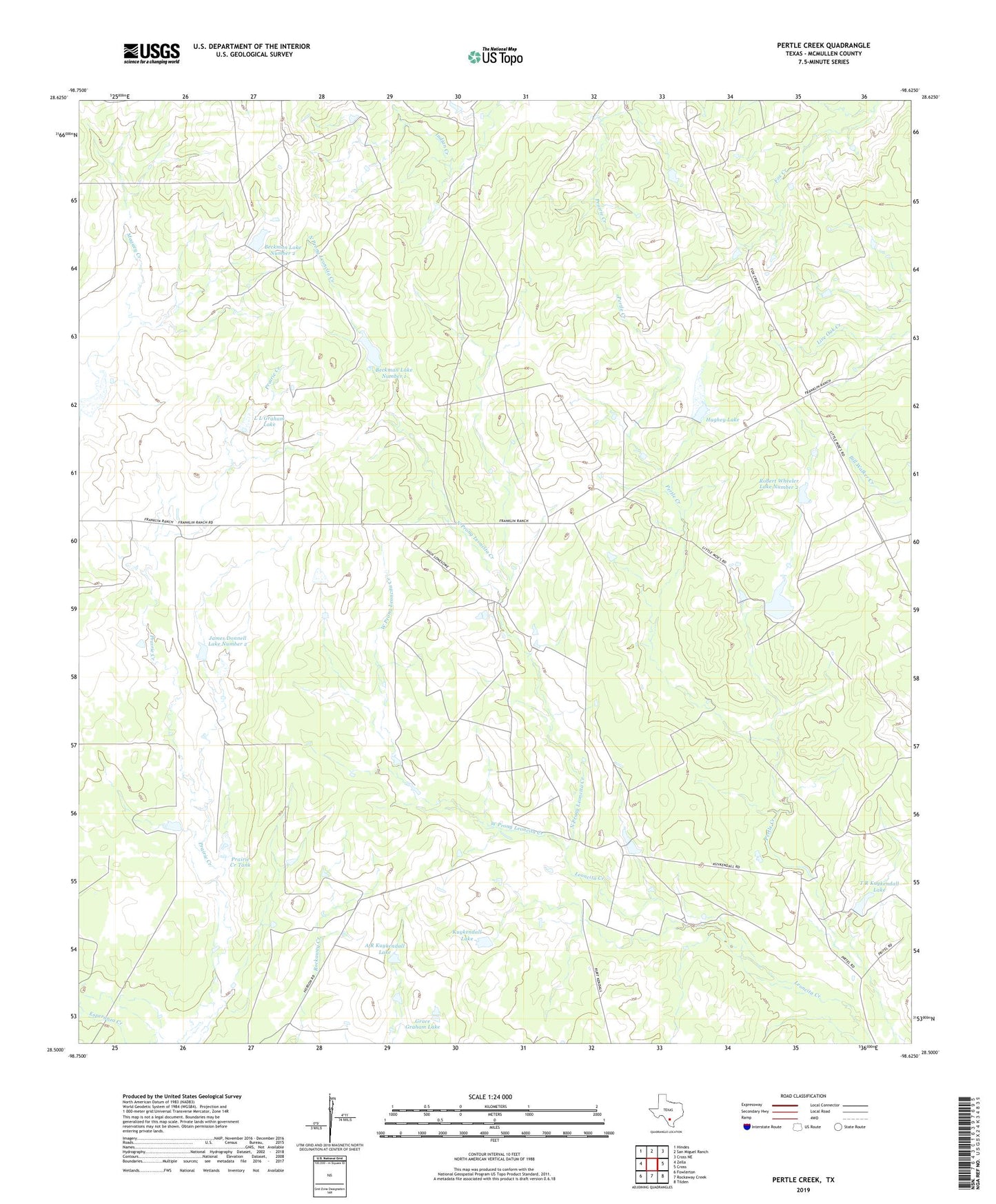
2019 topographic map quadrangle Pertle Creek in the state of Texas. Scale: 1:24000. Based on the newly updated USGS 7.5' US Topo map series, this map is in the following counties: McMullen. The map contains contour data, water features, and other items you are used to seeing on USGS maps, but also has updated roads and other features. This is the next generation of topographic maps. Printed on high-quality waterproof paper with UV fade-resistant inks.
Quads adjacent to this one:
West: Zella
Northwest: Hindes
North: San Miguel Ranch
Northeast: Cross NE
East: Cross
Southeast: Tilden
South: Rockaway Creek
Southwest: Fowlerton
Contains the following named places: A R Kuykendall Lake, A R Kuykendall Lake Dam, Beckman Lake Number 1, Beckman Lake Number 1 Dam, Beckman Lake Number 2, Beckman Lake Number 2 Dam, Grace Graham Lake, Grace Graham Lake Dam, Great Northwest Branch Library, Hughey Lake, James Donnell Lake Number 2, James Donnell Lake Number 2 Dam, Johnston Branch Library, Kuykendall Lake, Kuykendall Lake Dam, L L Graham Lake, L L Graham Lake Dam, North Prong Leoncita Creek, Prairie Creek Tank, Robert Wheeler Lake Number 1, Robert Wheeler Lake Number 1 Dam, Robert Wheeler Lake Number 2, Robert Wheeler Lake Number 2 Dam, Robert Wheeler Lake Number 3 Dam, T R Kuykendall Lake, T R Kuykendall Lake Dam, West Prong Leoncita Creek