MyTopo
Cross NE Texas US Topo Map
Couldn't load pickup availability
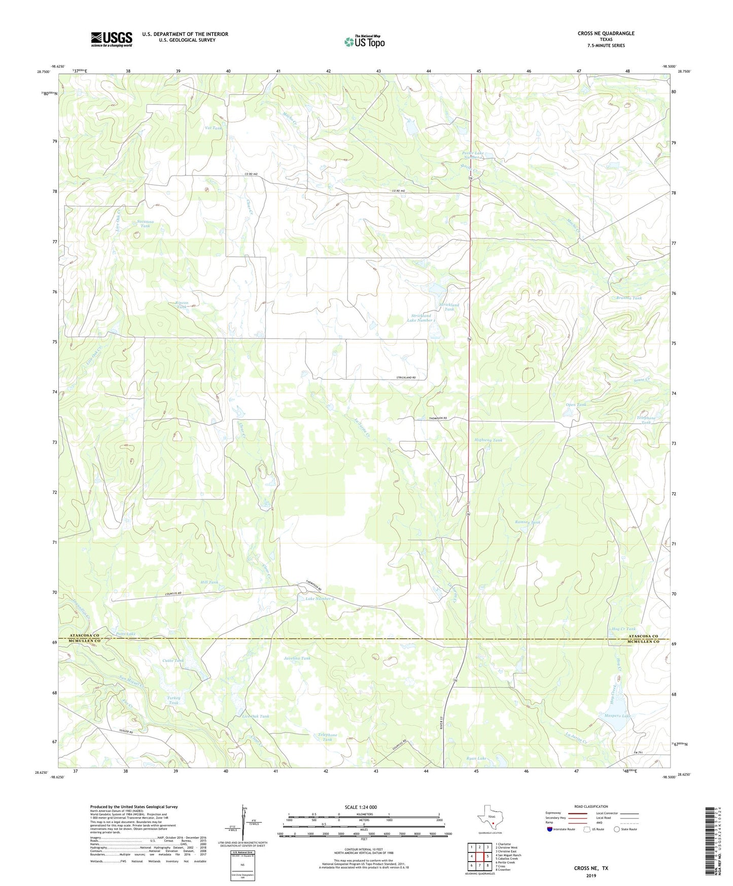
2022 topographic map quadrangle Cross NE in the state of Texas. Scale: 1:24000. Based on the newly updated USGS 7.5' US Topo map series, this map is in the following counties: Atascosa, McMullen. The map contains contour data, water features, and other items you are used to seeing on USGS maps, but also has updated roads and other features. This is the next generation of topographic maps. Printed on high-quality waterproof paper with UV fade-resistant inks.
Quads adjacent to this one:
West: San Miguel Ranch
Northwest: Charlotte
North: Christine West
Northeast: Christine East
East: Caballos Creek
Southeast: Crowther
South: Cross
Southwest: Pertle Creek
This map covers the same area as the classic USGS quad with code o28098f5.
Contains the following named places: Brahma Tank, Cuate Tank, Cuate Tank Dam, Ernst Dam, Ernst Lake, Fox Creek, Highway Tank, Hill Tank, Hog Creek, Hog Creek Tank, House Dam Number 1, House Dam Number 2, Javelina Tank, Lagunillas Creek, Lake Number 2, Las Palmas Branch Library, Leon Valley Public Library, Live Oak Tank, Live Oak Tank Dam, Masdero Lake Dam, Maspero Lake, Memorial Branch Library, Open Tank, Peeler Dam Number 1, Peeler Lake Number 1, Potts Dam, Potts Lake, Ramsey Tank, Rincon Tank, Ryan Lake, Ryan Lake Dam, Sacatosa Tank, Strickland Dam Number 1, Strickland Dam Number 2, Strickland Lake Number 1, Strickland Lake Number 2, Strickland Tank, Telephone Tank, Turkey Tank, Turkey Tank Dam, Vat Tank, Vat Windmill