MyTopo
Tilden Texas US Topo Map
Couldn't load pickup availability
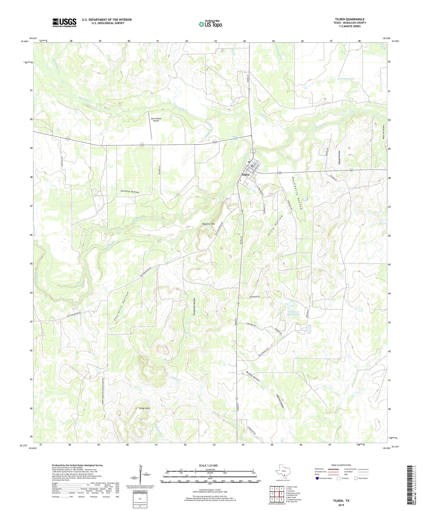
2022 topographic map quadrangle Tilden in the state of Texas. Scale: 1:24000. Based on the newly updated USGS 7.5' US Topo map series, this map is in the following counties: McMullen. The map contains contour data, water features, and other items you are used to seeing on USGS maps, but also has updated roads and other features. This is the next generation of topographic maps. Printed on high-quality waterproof paper with UV fade-resistant inks.
Quads adjacent to this one:
West: Rockaway Creek
Northwest: Pertle Creek
North: Cross
Northeast: Crowther
East: Calliham NW
Southeast: San Caja Hill
South: Fitzpatrick Hollow
Southwest: Mule Creek
This map covers the same area as the classic USGS quad with code o28098d5.
Contains the following named places: Aero Saylee Airport, Big Slough, Bill Walker Creek, Birds Nest Slough, Brushy Hollow, Cortez Branch Library, Cottonwood Creek, Dickenson Ranch Lake, Dickenson Ranch Lake Dam, Forest Hills Branch Library, Fourmile Hollow, Hackberry Hollow, Hals Lake, Javelina Hollow, Leoncita Creek, McMullen County Constable's Office, McMullen County EMS, McMullen County Sheriff's Office, Pertle Creek, Register Hill, Salt Branch, Sling Hollow, Sloppy Hollow, Threemile Hollow, Tilden, Tilden Census Designated Place, Tilden Post Office