MyTopo
Fowlerton Texas US Topo Map
Couldn't load pickup availability
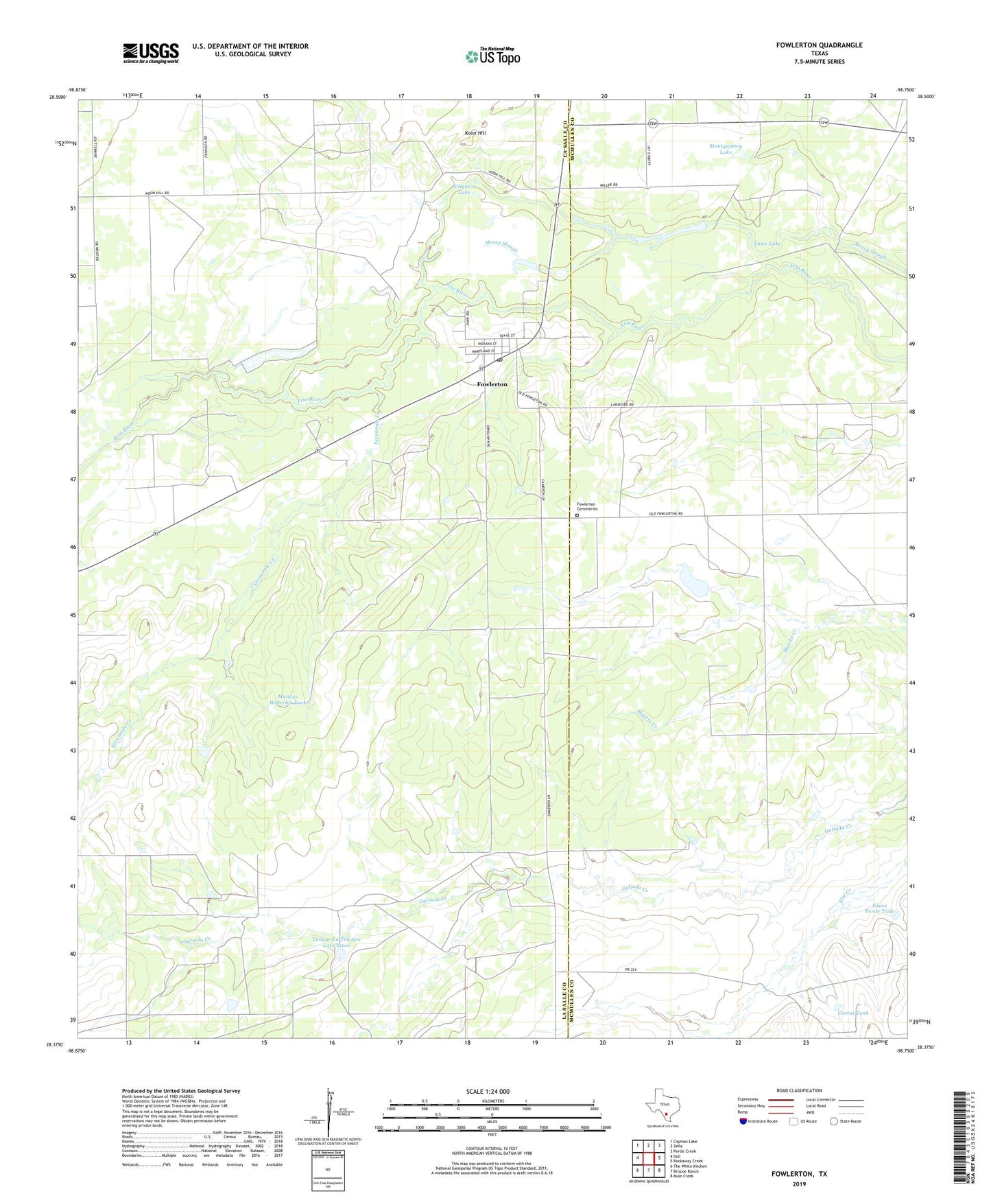
2022 topographic map quadrangle Fowlerton in the state of Texas. Scale: 1:24000. Based on the newly updated USGS 7.5' US Topo map series, this map is in the following counties: La Salle, McMullen. The map contains contour data, water features, and other items you are used to seeing on USGS maps, but also has updated roads and other features. This is the next generation of topographic maps. Printed on high-quality waterproof paper with UV fade-resistant inks.
Quads adjacent to this one:
West: Dull
Northwest: Cayman Lake
North: Zella
Northeast: Pertle Creek
East: Rockaway Creek
Southeast: Mule Creek
South: Briscoe Ranch
Southwest: The White Kitchen
This map covers the same area as the classic USGS quad with code o28098d7.
Contains the following named places: Alligator Lake, Corral Tank, Fowlerton, Fowlerton Cemeteries, Fowlerton Census Designated Place, Fowlerton Post Office, Galinda Ranch, Koon Hill, Lowe Lake, Mangas Flowing Well, Mangas Waterlot Tank, Medio Flowing Well, Miller Dam, Miller Lake, Montgomery Lake, Montgomery Lake Dam, Morton Lake, Morton Lake Dam, Sauce Verde Tank, Sevenmile Creek, Tanque La Trampa Los Chivos, ZIP Code: 78021