
MyTopo
Piedra Creek NE Texas US Topo Map
Couldn't load pickup availability
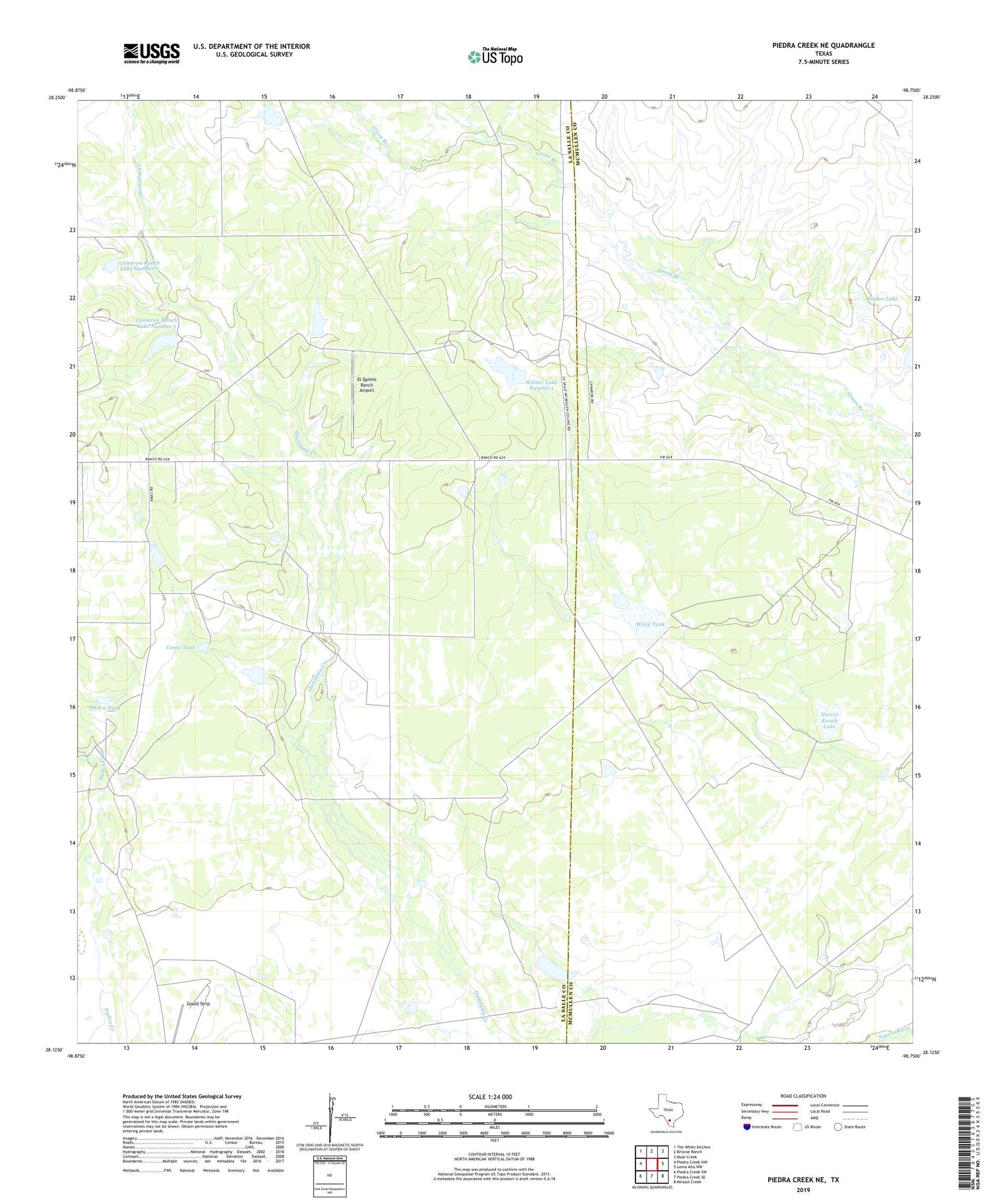
2019 topographic map quadrangle Piedra Creek NE in the state of Texas. Scale: 1:24000. Based on the newly updated USGS 7.5' US Topo map series, this map is in the following counties: La Salle, McMullen. The map contains contour data, water features, and other items you are used to seeing on USGS maps, but also has updated roads and other features. This is the next generation of topographic maps. Printed on high-quality waterproof paper with UV fade-resistant inks.
Quads adjacent to this one:
West: Piedra Creek NW
Northwest: The White Kitchen
North: Briscoe Ranch
Northeast: Mule Creek
East: Loma Alta NW
Southeast: Mirasol Creek
South: Piedra Creek SE
Southwest: Piedra Creek SW
Contains the following named places: Bob Hinces Lake Number 4, Bob Hinces Lake Number 4 Dam, Cameron Ranch, Cameron Ranch Lake Number 5, Cameron Ranch Lake Number 5 Dam, Cameron Ranch Lake Number 7, Cameron Ranch Lake Number 7 Dam, Coma Tank, El Quinto Ranch Airport, Hindes Lake, Hindes Lake Dam, House Lake, House Lake Dam, Nueces Ranch Lake, Nueces Ranch Lake Dam, Piedra Tank, Welder Lake Number 1, Welder Lake Number 1 Dam, Welder Lake Number 2, Welder Lake Number 2 Dam, Wiley Tank, Wiley Tank Dam


