MyTopo
Mule Creek Texas US Topo Map
Couldn't load pickup availability
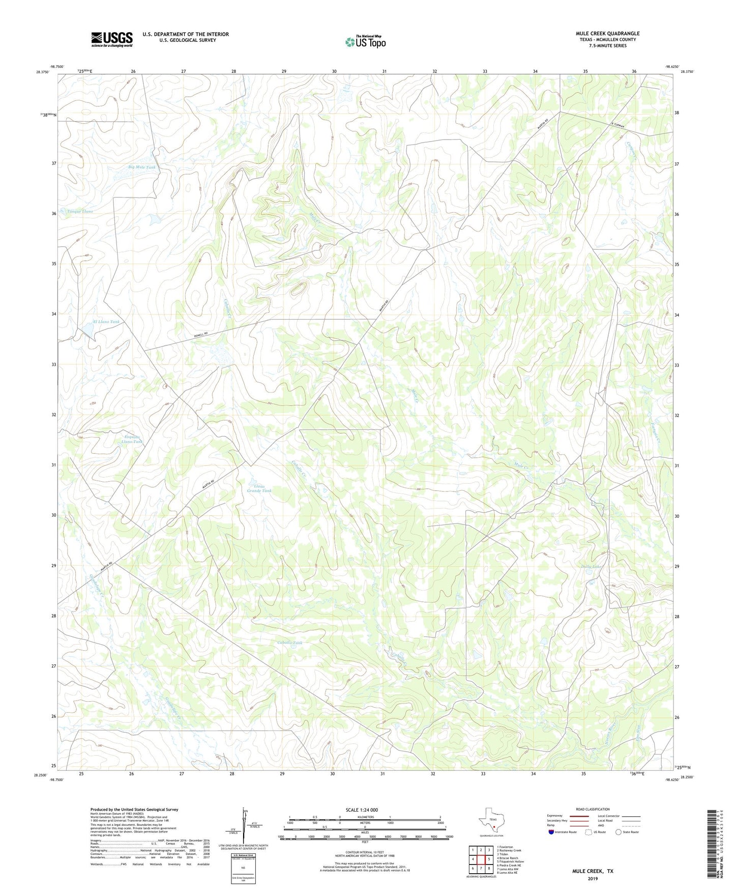
2022 topographic map quadrangle Mule Creek in the state of Texas. Scale: 1:24000. Based on the newly updated USGS 7.5' US Topo map series, this map is in the following counties: McMullen. The map contains contour data, water features, and other items you are used to seeing on USGS maps, but also has updated roads and other features. This is the next generation of topographic maps. Printed on high-quality waterproof paper with UV fade-resistant inks.
Quads adjacent to this one:
West: Briscoe Ranch
Northwest: Fowlerton
North: Rockaway Creek
Northeast: Tilden
East: Fitzpatrick Hollow
Southeast: Loma Alta NE
South: Loma Alta NW
Southwest: Piedra Creek NE
This map covers the same area as the classic USGS quad with code o28098c6.
Contains the following named places: Big Mule Tank, Big Mule Tank Dam, Caballo Creek, Caballo Tank, Dillworth Lake, Dillworth Lake Dam, Dully Lake, Dully Lake Dam, El Llano Tank, El Llano Tank Dam, Elm Slue, Esquina Llano Tank, Fortysix Creek, Llano Grande Tank, Llano Grande Tank Dam, McMullen County Historical Museum, Medio de Llano Tank, Medio de Llano Tank Dam, Noria Caliente Flowing Well, Tanque Llano