MyTopo
Piedra Creek NW Texas US Topo Map
Couldn't load pickup availability
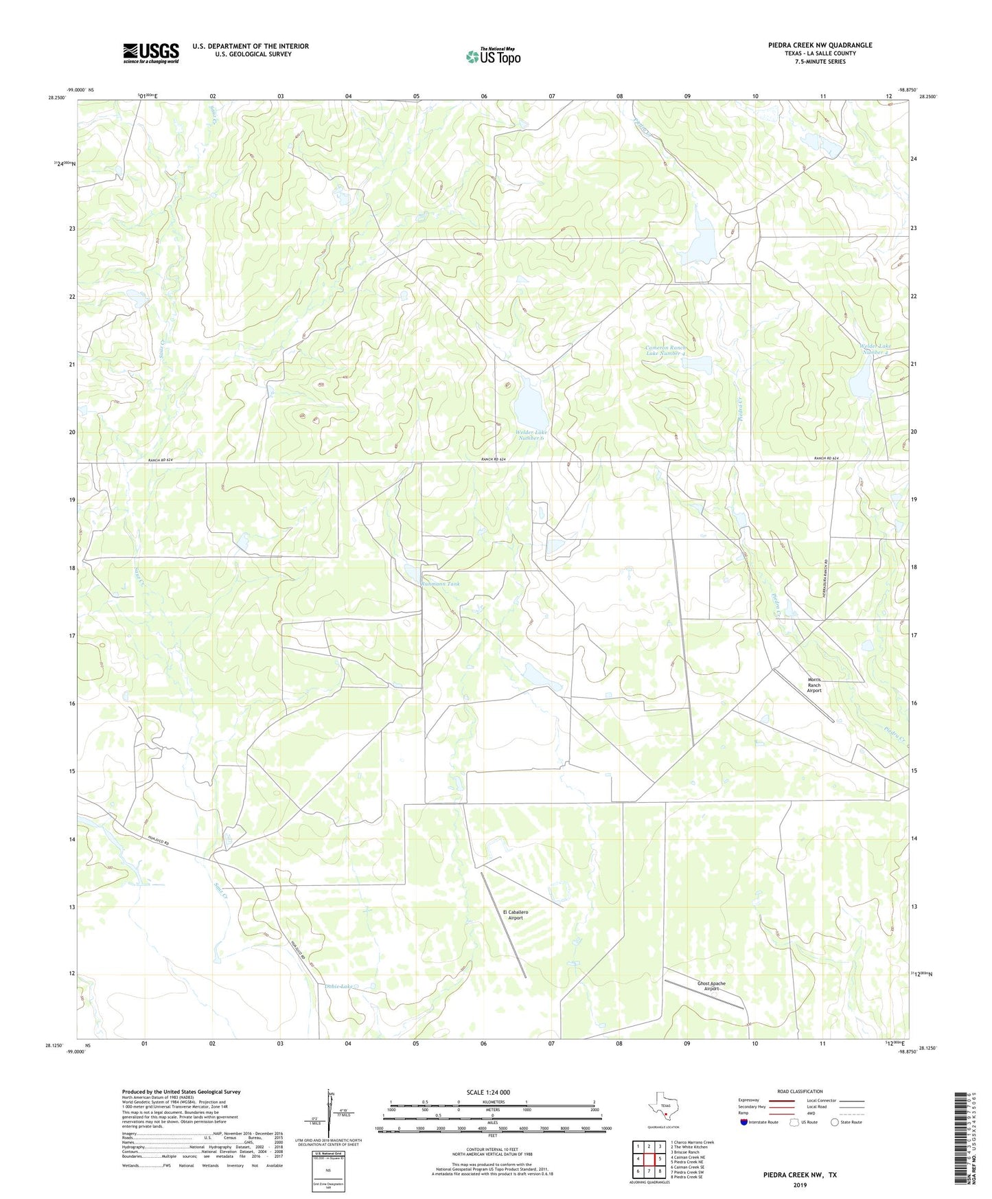
2022 topographic map quadrangle Piedra Creek NW in the state of Texas. Scale: 1:24000. Based on the newly updated USGS 7.5' US Topo map series, this map is in the following counties: La Salle. The map contains contour data, water features, and other items you are used to seeing on USGS maps, but also has updated roads and other features. This is the next generation of topographic maps. Printed on high-quality waterproof paper with UV fade-resistant inks.
Quads adjacent to this one:
West: Caiman Creek NE
Northwest: Charco Marrano Creek
North: The White Kitchen
Northeast: Briscoe Ranch
East: Piedra Creek NE
Southeast: Piedra Creek SE
South: Piedra Creek SW
Southwest: Caiman Creek SE
This map covers the same area as the classic USGS quad with code o28098b8.
Contains the following named places: Cameron Ranch Lake Number 4, Cameron Ranch Lake Number 4 Dam, Dobie Lake, Dobie Lake Dam, El Caballero Airport, Ghost Apache Airport, Graham Lake, Graham Lake Dam, Herradura Lodge Airport, La Mata Lake, La Mata Lake Dam, Morris Ranch Airport, Ruhmann Tank, Ruhmann Tank Dam, Welder Lake Number 3, Welder Lake Number 3 Dam, Welder Lake Number 4, Welder Lake Number 4 Dam, Welder Lake Number 5, Welder Lake Number 5 Dam, Welder Lake Number 6, Welder Lake Number 6 Dam